Core Difference: Definition and Function
IMU (Inertial Measurement Unit) - Inertial Measurement Unit
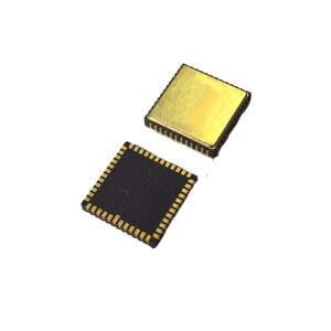
Definition: IMU is a sensing component. It contains a set of core sensors:
Gyroscope: Measures the angular velocity of an object around its three axes (pitch, roll, yaw).
Accelerometer: Measures the linear acceleration of an object along its three axes.
Function: IMU provides raw sensor data (angular velocity, acceleration). It does not calculate position, velocity or attitude by itself. IMU is the basic sensor unit of navigation system.
Limitation: IMU data drifts over time (integrated error). Even high-quality MEMS IMU (such as the one used in ER-GNSS/MINS-05, with zero bias instability <2°/h gyroscope, <25ug accelerometer), its position and attitude estimates will quickly accumulate errors within seconds or minutes, requiring external correction.
Integrated Navigation System (INS/GNSS, etc.) - Integrated Navigation System
Definition: Integrated navigation system is a complete navigation solution. It fuses data from the IMU with data from other sensors (most commonly Global Navigation Satellite Systems - GNSS, such as GPS, BeiDou, GLONASS, Galileo).
Core Components: An integrated navigation system usually contains an IMU as its core inertial sensor, and integrates a GNSS receiver (usually high-precision, multi-band, multi-system, such as the dual antenna module built into the ER-GNSS/MINS-05), as well as a powerful navigation computer and fusion algorithms (such as Kalman filters).
Function: The core task of the integrated navigation system is to fuse multi-source data:
Use GNSS to provide absolute position, velocity and time information (high precision, no long-term drift).
Use IMU to provide high-frequency, short-term accurate motion information (acceleration, angular velocity changes), and can maintain navigation for a short time when the GNSS signal is lost.
Through complex algorithms, the system outputs accurate, reliable and continuous full-attitude navigation information
Advantages:
Complementary advantages: Overcomes the drift problem of IMU and the signal blocking/interference problem of GNSS. For example, the ER-GNSS/MINS-05 can maintain 0.03° attitude and 0.06° heading accuracy when the RTK signal is interrupted for 30 seconds.
Higher accuracy and reliability: Provides comprehensive navigation accuracy far beyond the capabilities of a single sensor (such as ER-GNSS/MINS-05's positioning accuracy, 0.03m/s velocity measurement accuracy, and 0.1° real-time heading/attitude accuracy).
Continuous availability: In tunnels, urban canyons, forested areas, or interfered environments, when GNSS fails, the system relies on IMU for dead reckoning navigation to maintain uninterrupted position output.
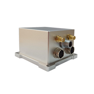
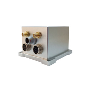
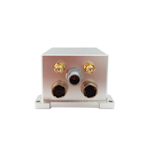
ER-GNSS/MINS-05: A model of low-cost MEMS integrated navigation system
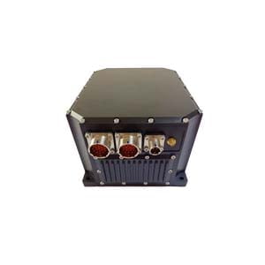
The ER-GNSS/MINS-05 perfectly illustrates the value of integrated navigation systems. It is much more than an IMU:
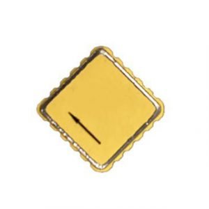
Core IMU components: It uses highly reliable, low-cost MEMS gyroscopes and accelerometers. Through advanced temperature compensation technology (-40℃~+80℃), the zero bias performance of these economical MEMS sensors in a wide temperature range is significantly improved, which is the basis for stable navigation.
Integrated GNSS module: Built-in full-band, full-system dual-antenna GNSS receiver. This not only provides high-precision positioning and speed measurement (single antenna mode), but more importantly, it realizes real-time high-precision orientation (dual antenna mode, baseline 1 meter, real-time 0.1°, post-processing 0.05°), which is a core function that a simple IMU or single-antenna GNSS cannot provide.
Powerful fusion engine: The system fuses and processes massive raw data from MEMS IMU and dual-antenna GNSS. The algorithm accurately compensates for IMU errors, combines GNSS data, and intelligently calculates when the signal is interrupted. This ultimately outputs full-parameter position, velocity, attitude, and heading information.
Performance output: Users get directly available navigation solution results (position, velocity, attitude, heading), rather than raw gyroscope and accelerometer data that needs to be processed by the user.
System-level optimization: The product design strikes a precise balance between cost, accuracy, reliability and stability. Through system-level optimization (hardware selection, algorithm compensation, temperature management, interface design), the core performance requirements of mainstream applications such as drones, unmanned vehicles, and precision agriculture are met (such as post-processing attitude accuracy of up to 0.03°) while significantly reducing hardware costs (especially compared to high-end fiber/laser IMUs).
Summary
In short, the IMU is the "sensory organ" of the integrated navigation system, providing raw motion data; while the integrated navigation system is the "brain", which integrates IMU data and other information sources (such as GNSS), and after complex calculations, outputs accurate, reliable, and complete navigation status information. The success of ER-GNSS/MINS-05 lies in its use of advanced engineering design and algorithms to integrate cost-effective MEMS IMUs with powerful dual-antenna GNSS, providing a truly practical and performance-compliant navigation solution for automated, unmanned, and precision applications while significantly reducing system costs.
More Technical Questions
1. What Is GNSS-aided MEMS INS and How Does It Work?
2. How to Improve the Performance of MEMS Inertial Navigation Systems?
3. Full-temperature Performance Optimization Method For MEMS accelerometer
4. Classification And Performance Improvement Of MEMS Gyroscope
5. MEMS Accelerometer Packaging Technology
6. Performance Analysis of GNSS RTK Timing


