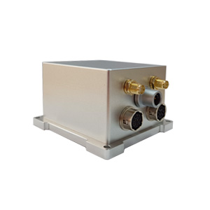
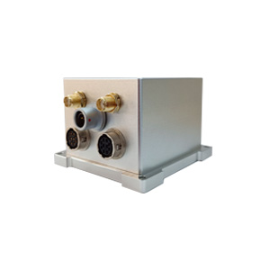
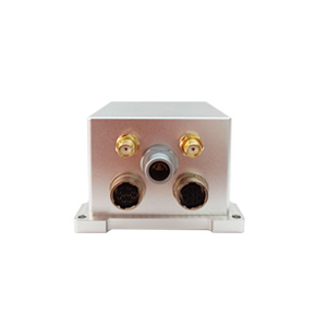
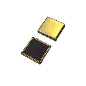
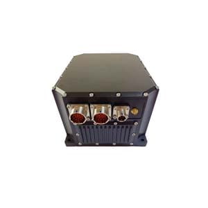
In the field of modern automation, whether it is a logistics drone shuttling between urban buildings, an agricultural machine that performs precise operations, or an underwater exploration robot, the cornerstone of its intelligence is inseparable from a core technology: reliable and accurate navigation and positioning. However, the real environment is full of challenges: satellite signals can be blocked, pure inertial navigation is expensive, and errors accumulate. A single technical route is difficult to meet the needs, which is why the MEMS integrated navigation system (GNSS/INS) has become an inevitable choice.
1.Inherent limitations of a single navigation technology
Vulnerability of satellite navigation (GNSS): dependence on external signals
Susceptible to environmental interference: GNSS signals will be severely attenuated or even completely lost in tunnels, underground, under dense vegetation, in urban canyons (between high-rise buildings), and in areas of strong electromagnetic interference.
Challenges of pure inertial navigation (INS): autonomous but with bottlenecks
High precision means high cost: INS with excellent performance (such as fiber optic gyroscope FOG or ring laser gyroscope RLG system) is expensive, limiting its popularity in cost-sensitive applications.
Errors accumulate over time: Core inertial sensors (gyroscopes and accelerometers) inevitably have small errors (such as zero bias, scale factor error, and noise). These errors will be continuously amplified during the integration operation (calculation of position and attitude), causing the navigation solution to drift over time and unable to maintain accuracy independently for a long time.
The core contradiction is highlighted: GNSS provides absolute, low-drift position/velocity when the signal is good, but is easily affected by the environment; INS is fully autonomous, high-frequency output, and can provide full attitude information, but there is an error accumulation problem and the high-precision solution is expensive. Used alone, neither can provide stable, accurate, and economical all-round navigation information in a complex environment for a long time.
2.Combined navigation: Fusion and complementation, breaking through limitations
The core value of the MEMS combined navigation system lies in deep sensor fusion. It does not simply piece together GNSS and INS, but integrates the data of both in real time through advanced data fusion algorithms, giving full play to their respective advantages and compensating for each other's disadvantages:
GNSS corrects INS: maintains long-term accuracy
When GNSS signals are available, its high-precision position and velocity information is used as an "absolute reference" to estimate and correct the error parameters (such as zero bias) of INS sensors (mainly gyroscopes and accelerometers) in real time, effectively suppressing the error accumulation trend of INS and ensuring the stability of the system's long-term operation.
INS assists GNSS: ensures continuity and enhances performance
Seamless connection when signal interruption occurs: When GNSS signals are blocked or interfered with (such as entering tunnels, under bridges, and in forest areas), INS uses its autonomy to immediately perform dead reckoning based on the data of the inertial measurement unit (IMU) and continuously output position, velocity, attitude, and heading.
Provide high-frequency motion perception: INS can provide high-frequency attitude, angular rate, and acceleration information of 100Hz, which is much higher than the GNSS update rate, meeting the stringent requirements of high-speed platforms (such as drones and racing cars) for real-time attitude control and stability.
Output full attitude information: INS continuously provides complete attitude angles (pitch, roll) and heading angles, which are the key to stable control of the carrier and precise operation (such as UAV terrain imitation flight and automatic steering of agricultural machinery). ER-GNSS/MINS-05 can achieve real-time attitude/heading accuracy of 0.1° (higher accuracy after post-processing).
Improve GNSS receiver performance: The precise carrier speed, attitude and even angular rate information provided by INS can be input to the GNSS receiver as auxiliary information to help it capture and track satellite signals faster in weak signal environments, enhance the ability to resist multipath interference, and may shorten RTK initialization time.
3.MEMS technology: the key to achieving the popularization of integrated navigation
Significant cost advantage: MEMS gyroscopes and accelerometers cost much less than traditional high-precision optical inertial devices. This makes the integrated navigation solution represented by ER-GNSS/MINS-05, which uses highly reliable and low-cost MEMS sensors, a viable option for cost-sensitive industries such as agriculture, logistics, and robotics.
Performance that meets the needs: Modern high-performance MEMS sensors, combined with precise temperature compensation technology (such as ER-GNSS/MINS-05 compensation within a wide temperature range of -40℃~+80℃) and advanced sensor fusion algorithms, have performance (such as gyro bias instability <2°/h, accelerometer bias instability <25μg) that can fully meet the requirements of a wide range of applications.
Miniaturization and integration: MEMS sensors are small in size, light in weight, and low in power consumption. They are easy to deeply integrate with GNSS receiving boards (such as the full-band full-system dual-antenna GNSS module built into ER-GNSS/MINS-05) to form a compact, low-power solution.
Summary
ER-GNSS/MINS-05 integrates high-reliability and low-cost MEMS IMU, high-performance full-band dual-antenna GNSS, data fusion algorithm and rich industrial interfaces (RS232/422, CAN), and achieves high-precision output of position, velocity, attitude and heading parameters and excellent signal interruption retention capability under strict cost control, providing key navigation components with "performance compliance, cost controllable and easy integration" for various application scenarios.
More Technical Questions
1. What Is GNSS-aided MEMS INS and How Does It Work?
2. How to Improve the Performance of MEMS Inertial Navigation Systems?
3. Full-temperature Performance Optimization Method For MEMS accelerometer
4. Classification And Performance Improvement Of MEMS Gyroscope
5. MEMS Accelerometer Packaging Technology
6. Performance Analysis of GNSS RTK Timing


