In the field of modern navigation and positioning, the Global Navigation Satellite System (GNSS) and the Inertial Navigation System (INS) are two core technologies. They each have unique advantages, but also have certain limitations. So, what are the differences between them? How to use them together to achieve more stable and accurate navigation?
GNSS vs. INS: Core Differences
1. GNSS (Global Navigation Satellite System)
Relies on satellite signals (such as GPS, Beidou, GLONASS, Galileo) for positioning.
Advantages: Provides absolute position, speed and time, with high long-term accuracy.
Limitations: Signals are easily interrupted in environments such as high-rise buildings, tunnels, and dense forests, affecting positioning continuity.
2. INS (Inertial Navigation System)
Autonomously calculates position and attitude based on inertial sensors (accelerometer + gyroscope).
Advantages: No reliance on external signals, high short-term accuracy, suitable for high dynamic or GNSS-denied environments.
Limitations: Accumulated errors over time (gyro drift, accelerometer zero bias), GNSS-assisted correction is required.
Best solution: GNSS/INS combined navigation
Through the GNSS+INS deep fusion algorithm, it can achieve:
✔ When the GNSS signal is good: high-precision absolute positioning + INS-assisted anti-interference
✔ When the GNSS signal is lost: INS short-term high-precision calculation to ensure uninterrupted navigation
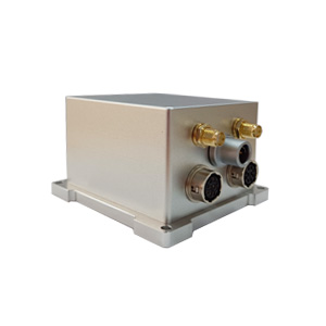
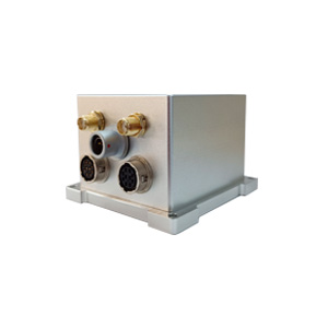
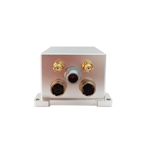
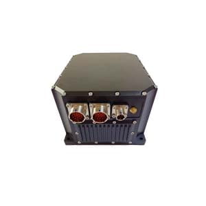
ER-GNSS/MIN-01: Surveying and mapping-grade GNSS/MEMS combined navigation system
For high-precision and high-reliability demand scenarios, ERICCO launched ER-GNSS/MIN-01, which uses full-band dual-antenna GNSS + high-precision MEMS inertial sensors to provide continuous, stable and accurate navigation data for drones, surveying and mapping, autonomous driving and other fields.
Core advantages
✅ Navigation-grade MEMS gyroscopes and accelerometers
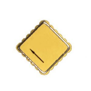
High reliability and high precision MEMS gyroscopes (bias instability <0.02°/h) and large-range high precision MEMS accelerometers (±60g, bias instability <2ug)
✅ Built-in full-band full-system dual-antenna positioning and orientation GNSS module
Supports single-antenna high-precision positioning and speed measurement, and supports dual-antenna fast orientation function.
✅ Surveying and mapping-grade system accuracy
The system can provide extremely accurate comprehensive navigation information, with attitude up to 0.01°, post-processing 0.004°, heading 0.05°, and post-processing 0.01°
✅ Satellite signal loss continues to maintain high precision
In urban canyons, tunnels, and forest areas, the system can still provide stable output and maintain high precision when satellite signals are interrupted or lost.
Why choose ER-GNSS/MIN-01?
Traditional single navigation methods are difficult to cope with complex environments, and ER-GNSS/MIN-01, through integrated navigation fusion algorithms, performs particularly well in the following scenarios:
Urban canyons, tunnels, forests: When GNSS signals are unstable, INS seamlessly connects
High-speed drones, vehicle-mounted dynamic measurement: high-frequency data output (100Hz+) to ensure accurate capture of motion posture
Long-term operation: GNSS continuously corrects inertial cumulative errors to avoid drift
Precise navigation starts with reliable hardware!
Contact us to obtain ER-GNSS/MIN-01 technical data and navigation solutions!
More Technical Questions
1. What Is GNSS-aided MEMS INS and How Does It Work?
2. How to Improve the Performance of MEMS Inertial Navigation Systems?
3. Full-temperature Performance Optimization Method For MEMS accelerometer
4. Classification And Performance Improvement Of MEMS Gyroscope
5. MEMS Accelerometer Packaging Technology
6. Performance Analysis of GNSS RTK Timing


