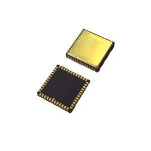
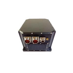
In the field of modern navigation technology, inertial navigation systems (INS) play a vital role, especially when used in conjunction with global navigation satellite systems (GNSS), they can provide continuous, reliable and high-precision positioning, velocity and attitude information.
Basic principles of inertial navigation systems
Inertial navigation systems are an autonomous navigation technology that does not rely on external information. It calculates position, velocity and attitude by measuring the acceleration and angular velocity of an object. Its core components include:
Inertial measurement unit (IMU): composed of gyroscopes and accelerometers, used to measure angular velocity and linear acceleration
Computation unit: converts raw measurement data into navigation information through integration
The working principle of inertial navigation systems is based on Newton's laws of motion - by measuring acceleration and integrating it over time, the change in velocity can be calculated; integrating it again can obtain the change in position. At the same time, the angular velocity measured by the gyroscope can be used to determine the change in the attitude of the object.
Technical breakthroughs in MEMS inertial navigation
Traditional high-precision inertial navigation systems usually use fiber optic or laser gyroscopes, which are bulky and expensive. The development of modern MEMS (micro-electromechanical system) technology has enabled inertial navigation systems to be miniaturized and cost-effective while maintaining high accuracy.
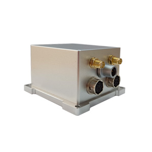
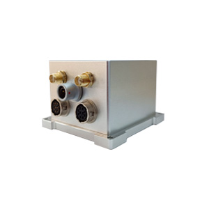
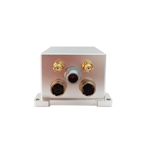
Taking ER-GNSS/MINS-01 as an example, this surveying-grade GNSS/MEMS INS combined navigation system uses advanced MEMS technology:
Gyroscope bias instability <0.02°/h
Accelerometer bias instability <2μg
Operating temperature range -40℃~+80℃
Weight <300g
These parameters show that modern MEMS inertial navigation systems can meet the needs of surveying-grade applications and provide high-precision navigation solutions for various mobile platforms.
Combination advantages of inertial navigation and GNSS
The use of inertial navigation systems alone has the problem of error accumulation over time, while GNSS is highly accurate but susceptible to occlusion and interference. The combined navigation system that combines the two can give full play to their respective advantages:
Continuous navigation capability: When the GNSS signal is lost, inertial navigation can provide short-term high-precision navigation information. For example, the ER-GNSS/MINS-01 can maintain an attitude and heading accuracy of 0.01° within 60 seconds after the satellite signal is lost.
Improve overall accuracy: GNSS can correct the cumulative error of inertial navigation, while inertial navigation can smooth the noise of GNSS and provide a more accurate navigation solution.
Enhance reliability: The combined system can still work in environments where GNSS signals are interfered (such as urban canyons, tunnels, etc.).
Fast orientation: Dual-antenna GNSS modules (such as those built into the ER-GNSS/MINS-01) can provide fast and accurate initial heading, solving the problem of slow initial alignment of traditional inertial navigation systems.
Key performance indicators of integrated navigation system
When evaluating the performance of an integrated navigation system, the following key indicators need to be paid attention to:
Attitude accuracy: ER-GNSS/MINS-01 can reach 0.01° (real-time), and can reach 0.004° after post-processing
Heading accuracy: 0.05° under dual-antenna GNSS, 0.01° after post-processing
Position holding capability: 0.2m (horizontal)/0.08m (vertical) when RTK signal is interrupted for 30 seconds, 0.5m (horizontal)/0.1m (vertical) when 60 seconds
Alignment time: only 3 minutes under dual-antenna GNSS, 5 minutes in a static environment without GNSS
These indicators directly determine the applicability and performance of the system in various application scenarios.
Summary
As the core component of integrated navigation, the inertial navigation system solves the limitations of a single navigation system by working in collaboration with GNSS, and provides a full range of high-precision navigation solutions for modern mobile platforms. With the continuous advancement of technology, high-precision MEMS combined navigation systems such as ER-GNSS/MINS-01 will play an important role in more fields and promote the development of emerging industries such as autonomous driving, intelligent transportation, and precision agriculture.
More Technical Questions
1. What Is GNSS-aided MEMS INS and How Does It Work?
2. How to Improve the Performance of MEMS Inertial Navigation Systems?
3. Full-temperature Performance Optimization Method For MEMS accelerometer
4. Classification And Performance Improvement Of MEMS Gyroscope
5. MEMS Accelerometer Packaging Technology
6. Performance Analysis of GNSS RTK Timing


