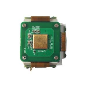
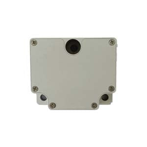
An inertial measurement unit (IMU) is a device that measures the three-axis attitude angle and acceleration of an object. Normally, an IMU contains three single-axis gyros and three single-axis accelerometers. The accelerometer detects the acceleration signals of an object in the independent three-axis of the carrier coordinate system, and the gyro detects the angular velocity signal of the carrier relative to the navigation coordinate system. Measure the angular velocity and acceleration of the object in three-dimensional space, and use this to solve the pose of the object. It has very important application value in navigation.
IMU provides a relative positioning information, its role is to measure the movement of the object relative to the starting point of the route, so it can not provide you with specific location information, therefore, it is often used together with GPS, when in some places where the GPS signal is weak, IMU can play its role, can allow the car to continue to obtain absolute position information, Don't get "lost."
Theoretical mechanics tells us that all motion can be decomposed into a linear motion and a rotary motion, and this inertial measurement unit is used to measure these two motions, linear motion can be measured by an accelerometer, and rotary motion is measured by a gyro. The wonderful combination of the two makes the inertial measurement unit come into being.
Principle:
By measuring the angular velocity of the earth's rotation, the true north value of the attached carrier is determined independently, without interference and influence from the external magnetic field or other environment. In addition, it can also be combined with acceleration for horizontal Angle measurement and correction.
Field of use:
Compared with other navigation systems, inertial navigation system has the important characteristics of comprehensive information, complete autonomy, high concealment, real-time and continuous information, and is not subject to time, region and human interference. It can work normally in various environments such as air, water and underground.In the Guidance navigation and control (GNC) system of missiles, rockets, aircraft and other vehicles that need to maneuver and operate at high speeds, Due to its wide measurement frequency band, high data frequency (up to hundreds of Hertz) and short measurement delay (up to less than 1 ms), the inertial system is easy to be digitized and becomes the core information source for GNC system to achieve fast and precise guidance and control. Its performance plays a key role in guidance accuracy. More than 70% of the hit accuracy of pure inertially guided ground-to-surface missile depends on the accuracy of the inertial system.Inertial technology is also widely used in civilian fields, such as geodesy, oil drilling, tunnel engineering, geological exploration, robotics, intelligent transportation, medical equipment, cameras, mobile phones, toys and so on. Therefore, where real-time sensitivity or measurement of object motion information is required, inertial technology can play an important role.
Equipping more sensors for each axis in the IMU can improve its reliability. Generally speaking, the IMU should be installed on the center of gravity of the measured object. The IMU is mostly used on devices that require motion control, such as cars and robots. It is also often used in situations that require precise displacement estimation using attitudes, such as inertial navigation equipment for submarines, aircraft, missiles, and spacecraft.
Development direction of inertial navigation technology
The main factors that need to be considered in the design and development of inertial navigation system are:
(1) Must be targeted at and meet the needs of the application, of which navigation performance (especially accuracy) and price cost are the first two characteristic indicators. The price cost includes the system's own cost, maintenance cost and service life. Therefore, for many navigation applications, reasonable price is still at the top of the application requirements. Navigation performance includes: navigation accuracy, continuity, integrity, ease of use, ease of use refers to the system is easy to use and maintain, system autonomy, etc.
(2)The actual application environment is the biggest challenge. The volume, power consumption, reliability and availability of the system will affect whether the inertial navigation system can be adopted in the specific application environment.
(3) Improve the universality of inertial navigation system and expand the application field.
If you want to get more details about IMU, pls visit https://www.ericcointernational.com/inertial-measurement-units
More Technical Questions
1.What are the advantages of MEMS IMU?
2.What are the Application Scenarios of the IMU?
3.What are the Components in IMU?
4.What are the disadvantages and remedies of IMU?
5.How to Qualitatively Evaluate the Dynamic Accuracy of IMU?
Products in Article