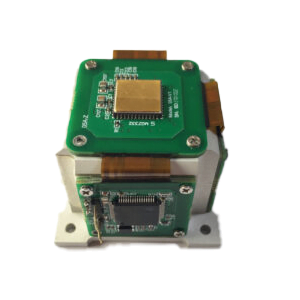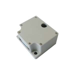

Introduction: Understanding North Finding System
In many navigation and positioning applications, knowing the accurate direction of North finding system is essential. Traditional magnetic compasses can provide directional information, but their accuracy is often affected by magnetic interference, nearby metal structures, and environmental conditions.
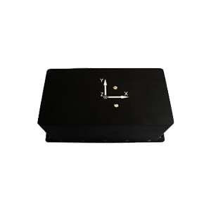
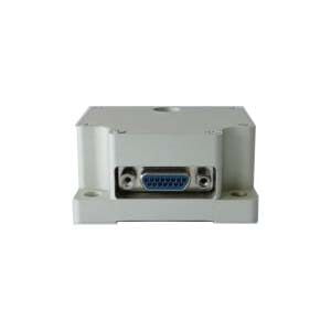
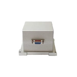
A north finding system is an advanced inertial navigation device designed to determine True North by measuring the Earth's rotation and calculating the azimuth angle without relying on GPS signals or magnetic references.
Unlike traditional navigation methods, a north finding system can operate independently in challenging environments such as underground mines, tunnels, military fields, and areas where GNSS signals are unavailable.
Today, north finding technology has become an important component in inertial navigation systems (INS), surveying equipment, autonomous vehicles, and precision positioning applications.
What Is a North Finding System?
A north finding system, also known as a north finder or north seeker, is a precision inertial device used to determine the direction of True North automatically.
The system mainly uses high-precision gyroscopes and accelerometers to detect:
- Earth's rotation rate
- Vehicle orientation
- Angular movement
- Gravity direction
By processing these measurements through advanced algorithms, the system calculates the azimuth angle and determines the exact direction of geographic north.
Unlike magnetic compasses, north finding systems do not depend on Earth's magnetic field.
This makes them highly reliable in environments where magnetic navigation becomes inaccurate.

How Does a North Finding System Work?
The working principle of a north finding system is based on the Earth's rotation.
The Earth rotates around its axis at a constant angular velocity of approximately:
15 degrees per hour
A high-precision gyroscope inside the north finder can detect this extremely small rotational movement.
The basic working process includes:
1. Measuring Earth's Rotation
The gyroscope detects the Earth's rotational angular velocity.
Because Earth's rotation direction is fixed, the system can identify the reference direction of geographic north.
2. Detecting Gravity Direction
Accelerometers measure the gravity vector to determine the horizontal reference plane.
This allows the system to separate:
- horizontal movement
- tilt angle
- rotation information
3. Data Processing and Calculation
The collected sensor data is processed through navigation algorithms.
The system calculates:
- latitude information
- heading angle
- azimuth direction
- alignment accuracy
Finally, the system outputs the True North direction.
Main Components of a North Finding System
A high-performance north finding system usually includes several key components.
1. Gyroscope
The gyroscope is the core sensor responsible for detecting Earth's rotation.
Common technologies include:
Fiber Optic Gyroscope (FOG)
FOG technology provides:
- extremely high accuracy
- excellent stability
- strong environmental resistance
It is commonly used in:
- military navigation
- precision surveying
- aerospace systems
MEMS Gyroscope
MEMS gyroscopes provide:
- compact size
- low power consumption
- affordable cost
They are suitable for:
- portable navigation devices
- commercial applications
- industrial measurement systems
2. Accelerometer
Accelerometers measure gravitational acceleration and help determine:
- horizontal reference
- system inclination
- movement changes
High-quality accelerometers improve the overall alignment accuracy.
3. Navigation Algorithm
Sensor data alone cannot determine north direction.
Advanced algorithms are required to:
- remove sensor noise
- compensate errors
- calculate azimuth angle
- improve stability
The quality of the algorithm directly affects the final north finding accuracy.
Types of North Finding System
Different applications require different levels of accuracy and performance.
1. FOG North Finding System
Fiber Optic Gyroscope (FOG) north finders are designed for high-precision applications.
Advantages:
- high accuracy
- excellent reliability
- long service life
- strong resistance to vibration
Typical applications:
- military equipment
- directional drilling
- precision surveying
- offshore engineering
2. MEMS North Finding System
MEMS-based north finding systems use micro-electromechanical sensors.
Advantages:
- smaller size
- lower cost
- lower power consumption
Typical applications:
- handheld devices
- industrial measurement
- mobile navigation systems
3. Dynamic North Finding System
Dynamic north finding systems can determine direction while the carrier is moving.
They are suitable for:
- vehicles
- ships
- autonomous platforms
Compared with static systems, dynamic systems require stronger algorithms to handle movement and vibration.
North Finding System vs Magnetic Compass
Many users compare north finders with traditional magnetic compasses.
| Feature | North Finding System | Magnetic Compass |
|---|---|---|
| Reference | Earth rotation | Magnetic field |
| GPS required | No | No |
| Affected by metal objects | No | Yes |
| Accuracy | High | Medium |
| Underground operation | Excellent | Limited |
| Professional applications | Yes | Limited |
A magnetic compass works well in simple environments.
However, when high accuracy is required, a north finding system provides much better reliability.

Applications of North Finding System
North finding technology is widely used across many industries.
1. Mining and Underground Survey
Underground environments often have:
- no GPS signal
- strong magnetic interference
- limited visibility
North finding systems allow engineers to perform accurate directional measurements.
2. Directional Drilling
In oil and gas exploration, accurate azimuth measurement is critical.
North finders help drilling systems determine:
- borehole direction
- drilling trajectory
- underground positioning
3. Military Navigation
Military systems require reliable navigation without GPS.
North finding systems are used in:
- weapon positioning
- vehicle navigation
- artillery alignment
4. Aerospace and Marine Applications
Aircraft and marine systems require stable heading information.
North finding systems provide independent orientation references.
How Accurate Is a North Finding System?
| Performance Parameters | ||
| Project | Parameter | Unit |
| Gyroscope performance | ER-MIMU-09A | / |
| Measuring range | 50 | deg/s |
| Scale factor (25°C) | 160000 | LSB/deg/s |
| Scale factor repeatability (1σ) | <50 | ppm |
| Scale factor temperature drift (1σ) | 300 | ppm |
| Scale factor nonlinearity (1σ) | <200 | ppm |
| Bias Instability (Allan Curve 1σ, 25°C) | <0.01 | deg/hr |
| Bias instability (10s standard deviation, 1σ, 25°C) | <0.05 | deg/hr |
| Angular Random Walk (ARW) | <0.0025 | °/√h |
| Bias repeatability (1σ, 25°C) | <0.1 | deg/hr |
| Accelerometer performance | ||
| Measuring range | 30 | g |
| Bias Instability (10s 1σ) | <75 | ug |
| Bias repeatability over a month (1σ) | 100 | ug |
| Zero-bias temperature coefficient | <20 | ug/℃ |
| Zero-bias temperature hysteresis | <1 | mg |
| Scaling nonlinearity | <500 | ppm |
| Scale monthly repeatability | <30 | ppm |
| Scale temperature coefficient | 100 | ppm/℃ |
| second-order nonlinear coefficient | <100 | ug/g² |
| Scale mark | 250000 | Lsb/g |
| Operating Environment and Voltage | ||
| Operating temperature | -40~+80 | ℃ |
| Storage temperature | -55~+105 | ℃ |
| Power supply | 6~12V DC | V |
| Power | 2 | W |
| Communication interface | RS-422 | |
| Physical properties | ||
| Size | 120xφ30 | mm |
| Weight | ≤150 | g |
How to Choose the Right North Finding System?
When selecting a north finder, consider the following factors.
1. Required Accuracy
For:
- military
- surveying
- drilling
high precision FOG systems are usually preferred.
For:
- portable equipment
MEMS systems may provide better cost performance.
2. Operating Environment
Consider:
- temperature range
- vibration
- shock
- installation conditions
Harsh environments require stronger sensor stability.
3. Size and Power Requirements
Portable applications usually require:
- lightweight design
- low power consumption
Large systems may prioritize accuracy over size.
4. Integration Requirements
Check compatibility with:
- INS systems
- navigation platforms
- control systems
FAQ
Q: Does a north finding system require GPS?
A: No. A north finder determines True North by measuring Earth's rotation and does not rely on GPS signals.
Q: Can a north finder work underground?
A: Yes. This is one of the main advantages of inertial north finding technology.
It is widely used in mining and underground surveying.
Q: What is the difference between True North and Magnetic North?
A: True North points toward Earth's geographic North Pole.
Magnetic North is based on Earth's magnetic field and changes over time.
North finding systems determine True North.
Q: Is a north finder better than a compass?
A: For professional applications requiring high accuracy, yes.
North finders are more reliable because they are not affected by magnetic interference.
Why Choose ERICCO North Finding Solutions?
ERICCO provides high-performance inertial navigation solutions based on advanced gyroscope technology.
Our north finding systems are designed for applications requiring:
- high precision
- reliable operation
- harsh environment performance
- integration flexibility
With experience in inertial sensors and navigation technology, ERICCO supports customers in industries including:
- surveying
- mining
- aerospace
- defense
- industrial navigation
If you need a customized north finding solution, contact ERICCO engineers for professional technical support.
Conclusion
A north finding system is an advanced inertial navigation device that determines True North by measuring Earth's rotation.
Compared with traditional magnetic navigation methods, it provides higher accuracy, stronger environmental adaptability, and independent operation without GPS.
From underground mining to aerospace navigation, north finding technology plays an increasingly important role in modern positioning and orientation systems.
Understanding the working principle, types, applications, and selection factors can help engineers choose the right north finder solution for their specific needs.
More Technical Questions
1.What is the Device Interface Definition of MEMS North Seeker
2.How to Use Acquisition Software of MEMS North Seeker
3.What Performance is the FOG sensor in FOG North Finder
4.What Performance is the Accelerometer Sensor in FOG North Finder
5.What is the System Structure of FOG North Finder
6.What is the System Structure of FOG North Finder
Products in Article