

Introduction
North finder in surveying in underground drilling, mining exploration, and directional surveying projects, obtaining accurate orientation information is essential for maintaining the planned trajectory and improving operational efficiency.
However, traditional navigation methods often face significant challenges. GPS signals cannot penetrate underground environments, while magnetic compasses are easily affected by nearby steel structures, drilling equipment, and geological formations.
To address these limitations, engineers increasingly rely on MEMS-based north-finding technology.
A north finder in surveying is an inertial navigation device that uses MEMS gyroscopes and accelerometers to determine orientation and true north without relying on GPS signals or magnetic references. Because it operates independently of external navigation sources, it is particularly suitable for drilling, mining, and other harsh industrial environments.
This article explains how north finder in surveying technology works, the factors affecting its accuracy, and why it has become an important component in modern drilling tools.
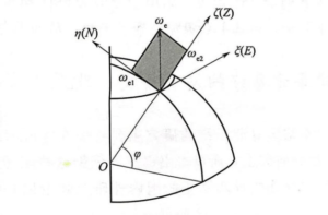
Why are north finder in surveying important for drilling applications?
Modern drilling operations require precise knowledge of tool orientation throughout the drilling process.
Three major challenges commonly affect underground navigation:
1. GPS Signal Loss
Satellite signals cannot penetrate deep underground formations, making GNSS-based navigation ineffective.
2. Magnetic Interference
Traditional compass-based systems can experience significant errors due to:
- Steel drill strings
- Casing pipes
- Electrical equipment
- Magnetic geological formations
3. Limited Installation Space
Downhole tools require compact and lightweight components that can withstand vibration, shock, and temperature variations.
MEMS north-finding technology addresses all three challenges by providing autonomous orientation information in a compact and rugged package.
Working principle of a north finder in surveying
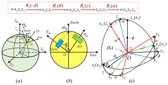
A north finder in surveying combines inertial sensors, signal processing electronics, and navigation algorithms to calculate orientation.
Three-Axis MEMS Gyroscope Measurement
The core of the system consists of three high-performance MEMS gyroscopes that continuously measure angular velocity around the X, Y, and Z axes.
These sensors detect rotational motion and provide the fundamental data required for orientation estimation.
In the ER-MIMU-06 system, the gyroscope bias instability can reach less than 0.01°/hour, while angular random walk is better than 0.0025°/√hour, providing a strong foundation for precision navigation.
Accelerometer-Based Gravity Reference
Three-axis accelerometers measure linear acceleration and gravity vectors.
This information allows the system to establish a stable reference frame and determine:
- Pitch angle
- Roll angle
- Platform inclination
The accelerometer bias stability is better than 75 μg, supporting highly accurate attitude calculations.
Sensor Fusion and Error Compensation
Raw sensor outputs alone cannot provide reliable north-finding results.
The ER-MIMU-09A integrates:
- ARM-based data acquisition
- Sensor calibration
- Bias compensation
- Temperature compensation
- Error correction algorithms
These functions continuously improve measurement stability and reduce long-term drift.
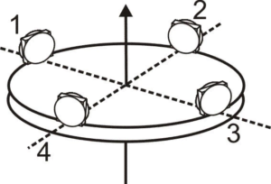
Internal Architecture of the ER-MIMU-09A
The system architecture consists of several functional modules:
- Three-axis MEMS gyroscope
- Three-axis MEMS accelerometer
- ARM processing unit
- Calibration and compensation module
- Navigation algorithm engine
- RS422 communication interface
The sensors collect motion data, which is processed by the onboard controller and converted into usable orientation information for drilling and surveying applications.
Key Performance Advantages
High Gyroscope Stability
Accurate north finding depends heavily on gyroscope performance.
| Parameter | ER-MIMU-09A |
|---|---|
| Bias Instability | <0.01°/h |
| Bias Stability (10s, 1σ) | <0.05°/h |
| Angular Random Walk | <0.0025°/√h |
These parameters enable reliable orientation measurement during long-duration operations.
Compact Design for Downhole Integration
Space constraints are one of the most important considerations in drilling tools.
The ER-MIMU-09A features:
- Length: 120 mm
- Diameter: 30 mm
- Weight: ≤150 g
Its compact structure allows integration into gyro survey tools, MWD systems, and rotary steerable systems.
Low Power Consumption
The unit consumes only 2 W under a 6 V power supply, helping reduce overall system energy requirements.
Wide Temperature Adaptability
Industrial drilling environments often experience significant temperature fluctuations.
The operating temperature range of -40°C to +80°C enables stable performance in demanding field conditions.
Engineering Challenges in Downhole North Finding
Vibration and Shock
Drilling equipment generates continuous vibration that can affect sensor measurements.
High-performance compensation algorithms are required to maintain navigation stability under dynamic conditions.
Temperature-Induced Drift
Sensor bias changes with temperature.
Without compensation, temperature variation can gradually reduce orientation accuracy.
The ER-MIMU-09A incorporates temperature compensation techniques to improve long-term stability across a wide operating range.
Installation Accuracy
Mechanical installation quality directly affects system performance.
For optimal results, installation error should remain below 0.05°. Proper alignment and secure mounting are critical for achieving high-accuracy measurements.
Applications in Drilling and Mining Industries
Gyro Survey Tools
Gyro survey tools require accurate orientation information to determine borehole direction.
MEMS IMUs provide reliable heading references without depending on magnetic measurements.
Measurement While Drilling (MWD)
MWD systems continuously monitor tool orientation during drilling operations.
The IMU supplies real-time motion and attitude information to support trajectory control.
Rotary Steerable Systems
Rotary steerable systems rely on accurate orientation data to control drilling direction.
MEMS inertial sensors help maintain the planned drilling path and improve operational efficiency.
Geological Steering
Geological steering applications require continuous directional information to guide drilling through targeted formations.
North-finding IMUs provide a reliable navigation reference in environments where traditional methods become unreliable.
Communication and Integration Capabilities
The ER-MIMU-09A supports RS422 communication and is designed for integration into industrial control systems.
Key communication features include:
- RS422 serial interface
- Adjustable baud rate
- Up to 921600 bps communication speed
- Default data update rate of 400 Hz
These capabilities allow seamless integration into drilling and navigation platforms.
Factors Affecting North-Finding Accuracy
Several factors influence final system performance:
Gyroscope Bias Stability
The lower the bias drift, the higher the long-term heading accuracy.
Accelerometer Accuracy
Accurate gravity measurements improve attitude estimation and reference frame alignment.
Calibration Quality
Sensor calibration significantly reduces systematic errors.
Temperature Compensation
Compensation algorithms help maintain consistent performance across varying environmental conditions.
Installation Precision
Mechanical alignment errors directly influence orientation output accuracy.
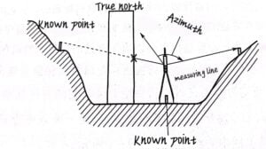
Why Choose ERICCO North finder in surveying Solutions?
Successful downhole navigation requires more than high-performance sensors.
Reliable north-finding performance depends on:
- Sensor quality
- Calibration methods
- Compensation algorithms
- Environmental adaptability
- System integration capability
The ER-MIMU-09A combines these elements into a compact MEMS inertial measurement unit specifically designed for drilling, mining, and industrial navigation applications.
FAQ
Q: Can a MEMS IMU be used in drilling tools?
A: Yes. MEMS inertial measurement units are widely used in gyro survey tools, MWD systems, and directional drilling applications.
Q: Why is MEMS technology suitable for downhole navigation?
A: MEMS sensors provide a combination of compact size, low power consumption, high reliability, and strong environmental adaptability.
Q: What affects MEMS north-finding accuracy?
A: The most important factors include gyroscope stability, sensor calibration, installation accuracy, and temperature compensation.
Q: Can MEMS north finders operate without GPS?
A: Yes. MEMS north-finding systems rely on inertial measurements and can operate independently of satellite signals.
Q: What communication interface does the ER-MIMU-09A support?
A: The unit supports RS422 communication with configurable baud rates and a default output rate of 400 Hz.
Conclusion
North finder in surveying technology has become an essential solution for drilling, mining, and underground navigation applications where GPS signals are unavailable and magnetic interference is unavoidable.
By combining high-performance MEMS gyroscopes, precision accelerometers, advanced calibration techniques, and intelligent navigation algorithms, systems such as the ER-MIMU-03 provide accurate and reliable orientation information in demanding industrial environments.
As drilling operations continue to demand higher precision and greater operational efficiency, MEMS-based north-finding solutions will play an increasingly important role in modern inertial navigation systems.
More Technical Questions
1.How to Choose an Appropriate North Finder?
2.The internal structure of the north finder
3.Technical innovation of north finder in directional drilling
4.Technical analysis of static north finding with MEMS north finder
5.How to Use Acquisition Software of MEMS North Seeker?
6.Research on Signal Acquisition of Strap-down North Seeker
Products in Article
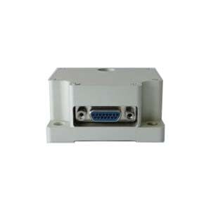
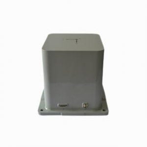
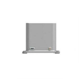
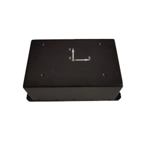
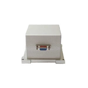
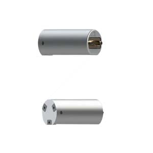 MEMS Triaxial North Seeker for Mining