

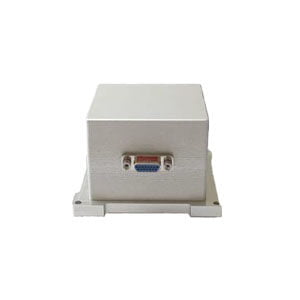
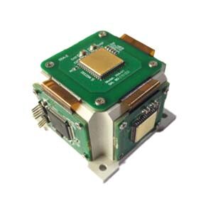
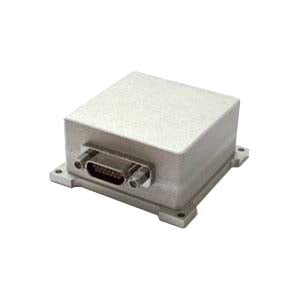
ER-MINS-5610 MEMS Inertial/Satellite Integrated Navigation System
Introduction
This MEMS inertial/satellite integrated navigation system is equipped with MEMS gyroscope and accelerometer and mapping multi-mode multi-frequency GNSS receiver. It can achieve a single antenna dynamic alignment or dual antenna-assisted fast high-precision orientation, and the directional accuracy can reach up to 0.1 deg.
This product is equipped with a new integrated navigation and fusion algorithm engine. Making use of the SFE for GNSS occlusion, multi-path interference to optimize the design, it can be used in cities, canyons and other complex environments to meet the requirements of long time, high precision, high reliability navigation application.
The product can support GNSS/odometer/DVL/barometric altimeter and other sensors external, with excellent scalability. Through the use of multi-sensor data fusion technology, and the combination of the inertial measurement and phase, it can make the system have geographical adaptability and robustness greatly improved. The product can meet the application requirements of marine surveying and mapping and map surveying, matching the original data storage, the level of surveying and mapping, and the post-processing software for surveying and mapping navigation. Users can match according to their needs.
Features
Serial port reads IMU and GNSS data
Combined navigation function, real-time calculation of the carrier's location, speed, heading and attitude and other information
Support GNSS real-time RTK function, able to store post-processing data
Provide standardized user general agreement to support the user according to their own needs
Two RS232 and RS422 serial interfaces are available to enhance the standardization and versatility of product features
Specifications


Applications

Application Techniques
1.Inertial Navigation System (INS)
2.What is Inertial Navigation System?
3.MEMS and FOG: How Should you Choose Inertial Navigation System?
4.In Autonomous Flight: How Inertial Navigation Systems Work
5.Development and Application of Inertial Navigation System
6.Introduction to Inertial Navigation Systems
More Products