Ericco provides high precision and low cost inertial geodetic survey system/instrument to the customers worldwide, the quality and after service are proven to be well guaranteed. Ericco also customizes various geodetic inertial survey systems according to the customers' special requirements. Just come and get more details with us.
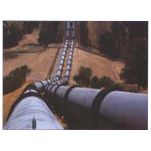
Pipe Inertial Mapping System
ER-PMINS (±3°) Features:
1. Long time high precision navigation technology (100h+);
2. High precision correction technology in mark spot;
3. Spiral trajectory error compensation technique;
4. Closed pipe "special situation" processing technology;
5. Pipeline environmental adaptability technology;
6. Accurate positioning in pipeline surveying and mapping.