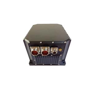
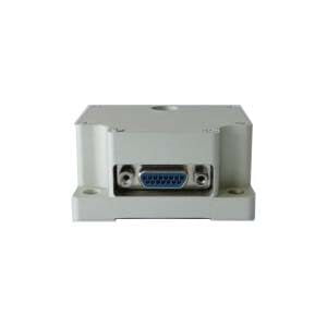
Inertial navigation system is a navigation parameter calculating system with gyro and accelerometer as the sensitive devices. The system establishes the navigation coordinate system according to the output of gyro, and calculates the velocity and position of the carrier in the navigation coordinate system according to the output of the accelerometer.
Inertial navigation is based on Newton's laws of mechanics. The accelerometer installed inside the carrier (aircraft, ship, rocket, etc.) measures the acceleration of the carrier in three axial directions, and the instantaneous velocity and position of the carrier are obtained by integral operation. A navigation method for measuring the attitude of a carrier. Inertial navigation systems typically consist of inertial measurement devices, computers, control displays, and the like.
The inertial measurement device includes an accelerometer and a gyroscope. A three-degree-of-freedom gyroscope is used to measure the three rotational motions of the aircraft; three accelerometers are used to measure the acceleration of the three translational motions of the aircraft. The computer calculates the speed and position data of the aircraft based on the measured acceleration signals. The control display displays various navigation parameters. Inertial navigation relies entirely on airborne equipment to complete navigation tasks autonomously. It does not rely on external information, does not radiate energy to the outside world, is not susceptible to interference, and is not subject to meteorological conditions. It is an autonomous navigation system with complete autonomy and resistance. Good interference, concealment, all-weather work, more output navigation information, and high data update rate. The actual inertial navigation can complete three-dimensional navigation of the space or two-dimensional navigation on the ground.
Inertial navigation system has the following advantages:
1, because it is not dependent on any external information, does not radiate energy to the outside of the autonomous system, so good concealment, is not affected by external electromagnetic interference;
2, can be all-weather, full time work in the air, the earth surface and even underwater;
3, can provide position, speed, heading and attitude Angle data, the generated navigation information continuity is good and low noise;
4, high data update rate, short-term accuracy and stability.
At present, it is necessary to develop a new inertial navigation system, which can improve the accuracy of the integrated navigation system. The new inertial navigation system has developed a variety of inertial navigation systems such as fiber inertial navigation, laser inertial navigation, and micro-solid inertial instruments. With the rapid development of modern MEMS, the development of silicon microgyroscopes and silicon accelerometers is progressing rapidly, and its low cost, low power consumption, small size and light weight are suitable for tactical applications. With the advancement of advanced precision machining processes and breakthroughs in key theories and technologies, there will be many types of high-precision inertial navigation devices, and the accuracy of combined guidance will also increase.
At the same time, navigation stability can be improved by increasing the combination factor. In the future, UAV navigation will place higher demands on the stability and reliability of integrated navigation. The combined navigation factor will have sufficient redundancy and no longer depend on one or a few technologies in the integrated navigation system. When one or several factors are not working properly due to unexpected situations, it will not affect the normal navigation needs of the drone.
UAV navigation is to properly direct the drone to the destination within a specified time along the scheduled route, according to the required accuracy. In order for the drone to successfully complete the scheduled navigation mission, in addition to the starting point and the location of the target, the navigation parameters such as the real-time position, navigation speed, and heading of the drone must be known.
The navigation technologies currently used on drones mainly include inertial navigation, satellite navigation, Doppler navigation, terrain-assisted navigation, and geomagnetic navigation. These navigation technologies have their own advantages and disadvantages. Therefore, in UAV navigation, it is important to select the appropriate navigation technology according to the different tasks of the drone.
If you want to get more details about INS,pls visit https://www.ericcointernational.com/inertial-navigation-system/
More Technical Questions
1.Inertial Navigation System (INS)
2.What is INS and How does it Work?
3.What is Inertial Navigation System?
4.In Autonomous Flight: How Inertial Navigation Systems Work
5.Introduction to Inertial Navigation Systems
6.MEMS and FOG: How Should you Choose Inertial Navigation System?
Products in Article