Definition of Inertial Navigation System
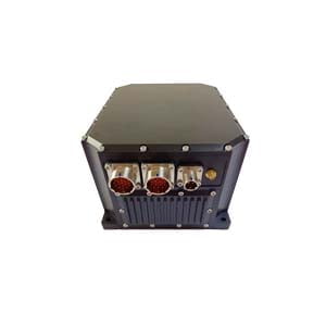
An inertial navigation system, commonly known as INS, is an electronic system that uses a variety of environmental sensors to detect and measure changes in the movement of objects. Using sensor data, the inertial navigation system can determine the position of a vehicle or object relative to its starting point - this is called dead reckoning.
Integrated navigation systems generally have the following three functions:
(1) Concord beyond function. The integrated navigation system can make full use of the navigation information of each subsystem to form the functions and precision that a single subsystem does not have.
(2) Complementary function. Since the integrated navigation system comprehensively utilizes the information of each subsystem, each subsystem can complement each other and expand the scope of use.
(3) Residual function. Each subsystem senses the same information source, making the measured values redundant and improving the reliability of the entire system.
Inertial sensors used in inertial navigation systems
There are many types of sensors used in inertial navigation systems, but the two main types are accelerometers and gyroscopes.
Accelerometers measure changes in linear velocity. Since most objects can move in three dimensions, three quadratically mounted accelerometers are commonly used; That is, the axis of each accelerometer is 90° from the axis of the other accelerometers. They are usually labeled with the X, Y, and Z axes.
Gyroscopes measure the speed of rotation, and since most objects can rotate freely in three dimensions, three gyroscopic axes are typically used. They are also orthogonally mounted on the object and aligned with the three accelerometer axes as much as possible.
Inertial sensor errors and corrections
The value of an inertial navigation system (INS) often depends on its accuracy. Some sensors do a better job than others, or have a wider operating threshold than others, for example, all sensors have inherent errors caused by the physical limitations of the sensing technology or materials used. This means that all accelerometers and gyroscopes will output information that contains an element of error.
Because sensor measurement errors are inherent, the farther the sensor is moved from its starting position, the errors accumulate. Therefore, it must be assumed that there will be some degree of error in the location information provided by INS. It can be said that in general, the more money you pay, the better the quality of the sensor and the higher the accuracy. As for which INS to choose, the question is usually dictated by precision requirements and budget.
Set course
The gyroscope itself will provide a heading value only relative to your starting position and does not indicate the object's heading relative to the North Pole. A common and low-cost method of course determination is to use another type of sensor called a magnetometer. Magnetometers measure the strength of the Earth's magnetic field and, again, use three magnetometers, arranged orthogonally with other sensors along three axes. As with accelerometers and gyroscopes, magnetometer axis measurements are combined into a single vector.
Magnetometers are not ideal in all cases because their measurements are very sensitive and therefore susceptible to interference, offset, and distortion from nearby iron-containing objects or devices that generate magnetic fields, such as electric motors.
There are many factors that cause measurement errors, and they cannot be avoided. However, there are ways to reduce some of these errors beyond just buying more expensive sensors. Error correction methods include factory calibration and characterization of the sensor over the operating temperature range, as well as sensor output filtering based on intelligent software.
Inherent sensor errors at the hardware level cannot be eliminated, which leads to complex mathematical and statistical filtering algorithms used in sensor data processing. These filters are designed to dynamically detect and eliminate biases (inherent errors) and errors caused by interference and noise, such as those caused by magnetic interference and vibration.
If you want to get more details about inertial-navigation-system,pls visit https://www.ericcointernational.com/inertial-navigation-system/
More Technical Questions
1.Inertial Navigation System (INS)
2.What is INS and How does it Work?
3.What is Inertial Navigation System?
4.MEMS and FOG: How Should you Choose Inertial Navigation System?
5.Development and Application of Inertial Navigation System
6.What is INS and How does it Work?
Products in Article
.jpg)
