As the key technology of UAV, navigation technology plays an important role in the research and commercial application of UAV. Navigation technology plays a role in the whole process of take-off, navigation and landing of UAV, ensuring the safety of UAV flight. Therefore, the research of navigation technology is the focus of UAV research field.
GPS is a satellite navigation system that calculates the position of devices by receiving signals from satellites on Earth. GPS technology is widely used in navigation, and it is also commonly used in UAV navigation system. GPS can provide global positioning information, but the accuracy is not high, usually only a few meters.GPS is indispensable to the current vehicle positioning technology. Due to the error of GPS, multipath and update frequency is low, we can't just rely on GPS positioning. Inertial sensor has high update frequency, it can be complementary with GPS. Using sensor fusion technology, we can be the integration of GPS and inertial sensor data, from each director, in order to achieve better location performance.
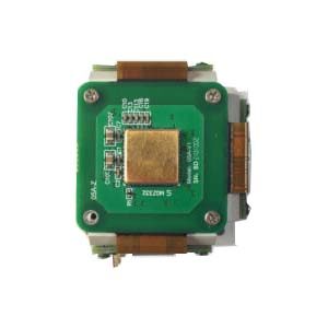
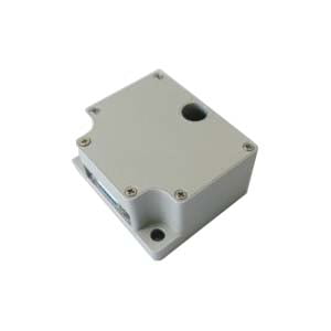
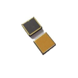
The IMU (Inertial Measurement Unit) is a sensor module that integrates a three-axis accelerometer and a three-axis gyroscope to measure the linear acceleration and angular velocity of an object. In the UAV, IMU plays an important role, it can provide accurate attitude and movement information, providing key data for the control and navigation of the UAV. The main role of the IMU is to help the drone maintain balance and attitude. The UAV will be affected by external factors in flight, such as wind speed, gravity, etc., which will cause the attitude of the UAV to change. By measuring the acceleration and angular velocity of the UAV in real time, the IMU can accurately identify the attitude change of the UAV, thus helping the UAV maintain balance. The application of IMU in UAVs is not limited to attitude control and flight stability. It can also be used with other sensors such as GPS (Global Positioning System) and magnetometers to provide more accurate navigation and positioning information. At the same time, IMU can also be used for UAV attitude estimation, motion detection, obstacle avoidance and other functions to improve the autonomy and safety of UAV. For more accurate stability, ER-MIMU-01 uses high-quality and reliable MEMS accelerometers and gyroscopes with bias instability up to 0.02 degrees/hour. Weighs only 70 grams.
The application of IMU in UAV is extensive and important. It provides critical data for drone control and navigation, enabling the drone to perform a variety of tasks efficiently. The application of IMU will vary depending on the design and use of different types of UAV.
Fixed-wing Drone: These drones are designed like traditional aircraft, with Fixed wings and tail fins. It is usually used for long-duration flight and large-scale reconnaissance missions, with high speed and flight stability. IMU is used for attitude control and flight stability maintenance in fixed-wing UAVs
Multi-rotor Drone: This type of drone provides lift and handling through multiple rotors, most commonly four - and six-rotor. The multi-rotor UAV has vertical takeoff and landing and hovering capabilities, which is suitable for close-range reconnaissance, aerial photography and logistics distribution tasks. Imus are used in multi-rotor UAVs for attitude control, flight stability and precise positioning.
Vertical Takeoff and Landing Transition Drone: This drone has a variable flight mode that can switch between vertical takeoff and landing and horizontal flight. It combines the advantages of fixed-wing UAVs and multi-rotor UAVs and is suitable for missions requiring long duration flight and flexible maneuvering. Imus play a key role in VTOL and transition UAVs for flight mode conversion and attitude control.
Inertial navigation system (INS) detecting acceleration and rotation motion of high frequency (1 KHZ) sensor, the inertial sensor data processing after the displacement and rotation of the vehicle can drawn real-time information. INS have bias and noise problems affect the outcome. By using a sensor fusion technique based on kalman filtering, we can be the integration of GPS and inertial sensor data, from each director, in order to achieve better location performance. Attention because of the unmanned for reliability and security requirement is very high, so based on GPS and inertial sensor positioning is not the only way of positioning in the unmanned, we also use LiDAR point cloud and high precision map matching, and locating methods such as visual mileage calculation method for various positioning method to correct each other to achieve more accurate results.
More Technical Questions
1.Application of IMU in UAV Flight Control System
2.Application of Quartz Accelerometer in UAV and Positioning System
4.What are the advantages of MEMS IMU?
5.Internal Structure Analysis of IMU
Products in Article