Global Navigation Satellite Systems (GNSS) have quietly become an integral part of our daily lives, revolutionizing the way we navigate, position, and interact with the world around us. In this article, an introduction to GNSS, we will embark on a journey to unravel the mysteries of GNSS, exploring what it is, how it works, and the myriad ways it impacts our modern existence.
Understanding GNSS: The Basics
GNSS is a space-based radio navigation and positioning system. It provides users with all-weather 3D coordinates and speed and time information at any location on the Earth's surface or near-Earth space. GNSS consist of three major components: the space segment, the control segment and the user segment.
The space segment encompasses GNSS satellites stationed at altitudes ranging from 19,000 to 36,000 kilometers (11,800 to 22,400 miles) above Earth. Each GNSS operates its dedicated constellation of satellites, strategically positioned in orbits to ensure optimal coverage. One familiar member of this celestial orchestra is the Global Positioning System (GPS), launched by the United States Department of Defense. However, GNSS is a broader term encompassing multiple constellations, each contributing its unique set of satellites. These constellations include Galileo (Europe), GLONASS (Russia), BeiDou (China), and others, forming a global network that blankets the Earth with signals.
Moving to the control segment, it comprises a ground-based network featuring master control stations, data uploading stations, and monitor stations. Within each GNSS system, the master control station meticulously adjusts satellite orbit parameters and high-precision onboard clocks, ensuring consistent accuracy.
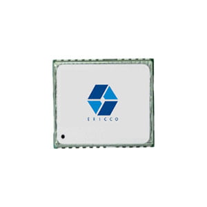
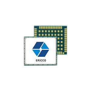
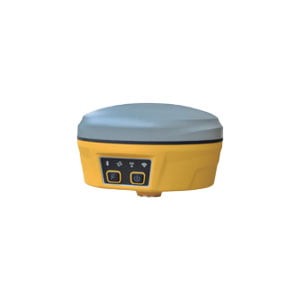
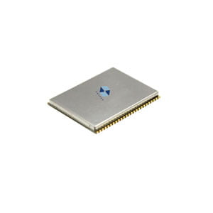
Finally, the user segment involves equipment that processes signals received from GNSS satellites, translating them into actionable location and time information. This equipment spans from commonplace smartphones and handheld receivers, commonly used by hikers, to sophisticated, specialized receivers tailored for high-end surveying and mapping applications.
How GNSS Works: The Dance of Satellites and Receivers
The working theory of GNSS is simple yet ingenious, employing the trilateration principle. GNSS receivers calculate the distance between the device and multiple satellites by measuring the time it takes for signals to reach the receiver. The intersection of three spheres in space represents the positioning location. In mathematical terms, the intersection of three spheres may have more than one point, but the remaining points are considered anomalies, such as not on the Earth's surface. From this perspective, a minimum of three satellites is required for positioning.
However, in practical applications, there are differences. Because GNSS signals need to propagate over significant distances, encountering numerous interferences and attenuations along the way, there is a substantial error in using a uniform time reference. Therefore, in actual applications, time is treated as a fourth variable: the time difference between the receiver's reference and the satellite's onboard clock. Adding more satellites can further enhance the accuracy of the calculated position. To improve precision, advanced correction techniques such as RTK or PPP may be employed. These systems correct errors caused by factors such as atmospheric conditions and satellite clock discrepancies.
Applications Across Industries: GNSS in Action
The impact of GNSS extends far beyond just finding our way on a road trip. The initial applications of GNSS technology outside the military domain were primarily focused on surveying and mapping. In the present day, GNSS has found extensive use across various commercial sectors, including agriculture, emergency response, machine control, transportation, autonomous vehicles, UAVs, and marine navigation. Its role applies to these sectors seeks efficiency through precise and continuously available position and time information. Furthermore, GNSS has permeated consumer applications, featuring prominently in vehicle navigation, mobile communications, entertainment, and athletics. As GNSS technology advances and becomes more cost-effective, an expanding array of applications is expected to emerge and evolve.
Beyond providing accurate positioning, GNSS receivers offer users highly precise time synchronization by aligning their local clocks with the high-precision clocks aboard satellites. This synchronization capability has given rise to transformative technologies and applications, facilitating the coordination of power grids, cellular systems, the Internet, and financial networks.
The Future of GNSS: Innovation Unleashed
As technology advances, so does the potential of GNSS. Emerging trends like sensor fusion, PPP, and RTK promise even greater accuracy and versatility in positioning systems. What's more, the fusion of GNSS with technologies like AI, IoT, and 5G will result in more intelligent, context-aware navigation systems. This integration is likely to enhance real-time decision-making and further the development of smart cities and interconnected infrastructure. Whether it's for optimizing delivery routes, improving public transportation, or advancing scientific research, GNSS continues to evolve, unlocking new possibilities.
In conclusion, GNSS have revolutionized the way we navigate and position ourselves on Earth. As we stand at the threshold of technological advancement, the future of GNSS holds exciting prospects and innovations. GNSS is not just a technological marvel; it's an invisible force shaping our interconnected world. From the simplicity of finding our way home to the complexity of optimizing global supply chains, GNSS is the unsung hero navigating us through the vast landscapes of the modern era. So, the next time you rely on your smartphone's map or glance at your in-car navigation system, remember that GNSS is at the heart of your journey, silently working to make your navigation experience seamless and precise.
I will appreciate it if you find this article helpful. Click the product and articles below and get more details about GNSS.
More Technical Questions
1. How to select a GNSS antenna?
2. The Difference and Connection between GPS and GNSS
3. High-precision GNSS receiver design
5. Scientific Farming, With The Help of GNSS
Products in Article


