A time service is a system or institution that provides accurate and synchronized timekeeping for a wide range of applications. From coordinating global financial transactions to ensuring the precision of scientific experiments, satellite timing are the backbone of countless industries and activities that rely on precise timing. This article mainly introduces satellite timing and its several application fields.
1.The History of Timing
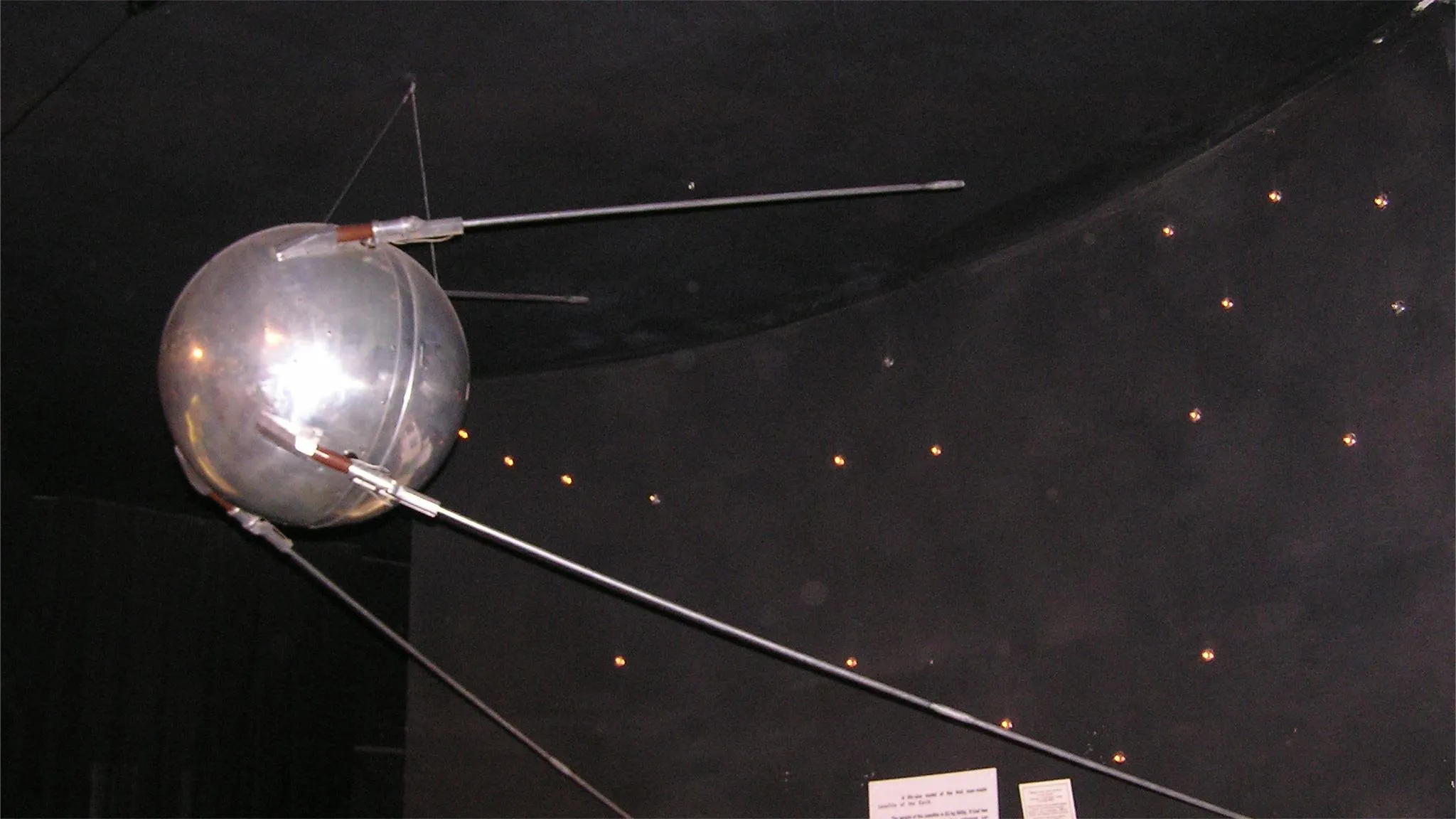
The history of satellite timing is closely intertwined with the development of satellite technology and the quest for accurate timekeeping on a global scale. The journey began with the launch of the first artificial satellite, Sputnik 1, by the Soviet Union on October 4, 1957. While Sputnik 1 itself did not carry precise timing equipment, its launch marked the beginning of the space age and paved the way for subsequent advancements in satellite-based timekeeping.
In the early years of space exploration, satellites primarily served scientific and military purposes. However, the need for precise timing capabilities became apparent as researchers and engineers sought to synchronize experiments, coordinate spacecraft operations, and facilitate communication across vast distances.
The concept of Global Navigation Satellite Systems (GNSS) emerged in the late 20th century, aiming to provide precise positioning, navigation, and timing services to civilian and commercial users worldwide. The Global Positioning System (GPS), developed by the United States Department of Defense, became the first fully operational GNSS, achieving initial operational capability in the 1980s. GPS utilized a constellation of satellites broadcasting precise timing signals synchronized with Coordinated Universal Time (UTC), enabling users to determine their precise position and time anywhere on Earth.
2.Satellite Timing and Other Methods of Timing
2.1 Shortwave timing
Timing is carried out using shortwave radio with wavelengths between 100m and 10m (frequencies: 3MHz to 30MHz).
Take China as an example. In Lintong, Shaanxi, there is the headquarters of the National Time Service Center of the Chinese Academy of Sciences. It is responsible for the generation, maintenance, and dissemination of China Standard Time (Beijing Time).
The time signal transmitter of the National Time Service Center is located in Pucheng, Shaanxi. Shortwave radio stations here use frequencies of 2.5MHz, 5MHz, 10MHz, and 15MHz to continuously broadcast China's shortwave radio time signal, with the call sign BPM.
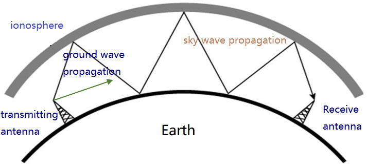
Shortwave time signals are transmitted via sky wave and ground wave. Ground waves can transmit up to 100 kilometers, while sky waves cover a radius of over 3000 kilometers, basically covering the entire territory of China, with timing accuracy at the millisecond level.
2.2 Longwave timing
Timing is carried out using longwave radio with wavelengths between 10km and 1km (frequencies: 30kHz to 300kHz).
The longwave radio station of the National Time Service Center of China has the call sign BPL, with a transmission frequency of 100kHz.
The ground wave range of longwave time signals is 1000-2000 kilometers, and the sky wave range is 3000 kilometers, basically covering inland areas and nearby sea areas of China, with timing accuracy at the microsecond level.
In addition, there are other methods of timing
- Low frequency time code timing
- Telephone timing
- TV timing
- Network timing
2.3 Satellite timing
People use navigation and positioning apps like Google Maps and Baidu Maps every day. We should also know that these apps are able to provide navigation and positioning because phones can communicate with satellites and use the services provided by satellites.
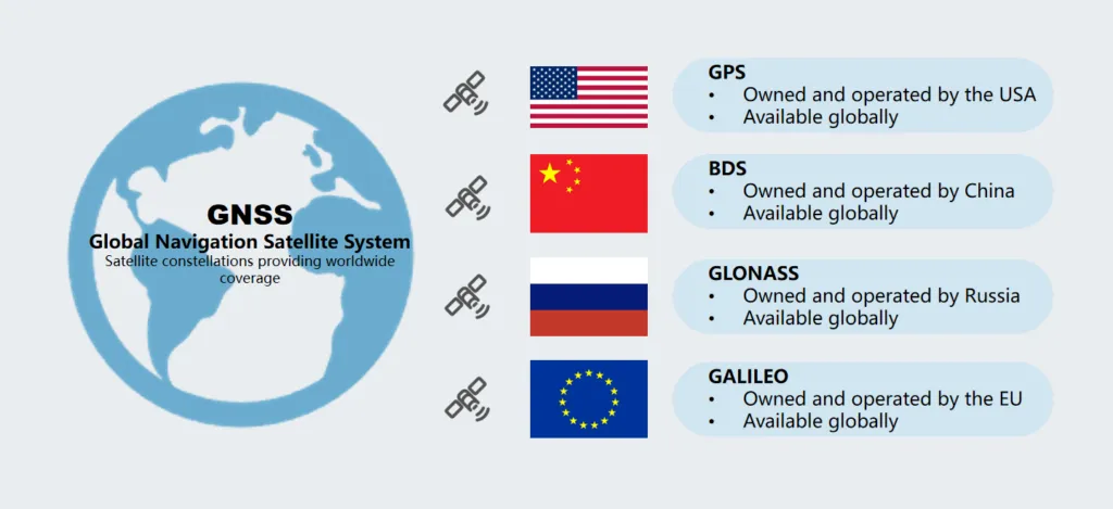
Navigation satellite systems that provide navigation and positioning services are called GNSS (Global Navigation Satellite Systems).
The GPS we are familiar with is the GNSS system of the United States and also the earliest GNSS system globally. The now-famous BeiDou is China's independently developed and constructed GNSS system. Other GNSS systems with global coverage capabilities include Russia's GLONASS and Europe's Galileo.
Many people do not know that in addition to positioning and navigation, GNSS systems also have a very important function, which is—timing. The three core capabilities of GNSS, commonly referred to as PVT (Position, Velocity, and Timing) .
Then, how does GNSS achieve time synchronization?
Each GNSS satellite is equipped with an atomic clock. This means that the satellite signals sent contain accurate time data. By decoding these signals using specialized receivers or GNSS timing modules, devices can be quickly synchronized with atomic clocks.
Compared to the previously mentioned longwave, and shortwave, GNSS satellite timing has significant technical advantages.
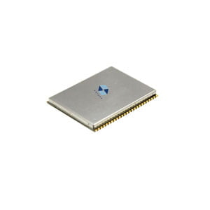
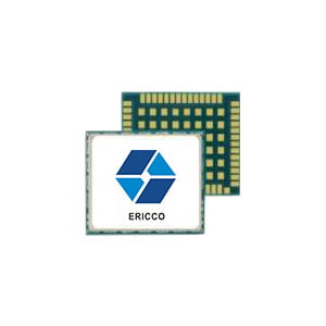
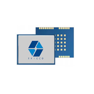
GNSS timing has higher accuracy. Take BeiDou as an example. The time of the BeiDou Satellite Navigation System is called BDT. BDT belongs to atomic time and can be traced back to Coordinated Universal Time (UTC) of China's National Time Service Center, with a time difference control accuracy to UTC of less than 100 nanoseconds. For example, high precision positioning module ER-GNSS-M01 possesses timing accuracy of 10 ns.
Table1. Accuracy of different timing means
| Timing Means | Timing accuracy | Timing Means | Timing accuracy |
| Internet Timing | 10 ms | Low Frequency Time Code Timing | 10 μs |
| Telephone Timing | 3.5 ms | Satellite Timing | 10 ns |
| Shortwave Timing | 1 ms | Satellite two-way timing | 1 ns |
| Longwave Timing | 1 μs | Dedicated fiber optic bi-directional timing | 10 ps |
Apart from accuracy, GNSS satellite timing also has inherent coverage advantages. Longwave and shortwave ground-based timing are limited by physical propagation distances. If there are obstacles like high mountains, the propagation distance will be further reduced. However, GNSS satellite timing has a much stronger coverage capability. Especially for scenarios like ocean navigation and aerospace.
3.Application of Satellite Timing Services
3.1 The Impact of GNSS Satellite Timing in the Aviation Field
In the aviation domain, GNSS satellite timing is crucial for ensuring flight safety. Pilots can utilize GNSS satellite timing to understand the aircraft's position and velocity, thereby enabling more accurate route planning and flight control. Additionally, GNSS satellite timing can be used for analyzing the causes of flight delays, assisting airlines in improving service quality.
3.2 Applications of Satellite Timing in the Communication Field
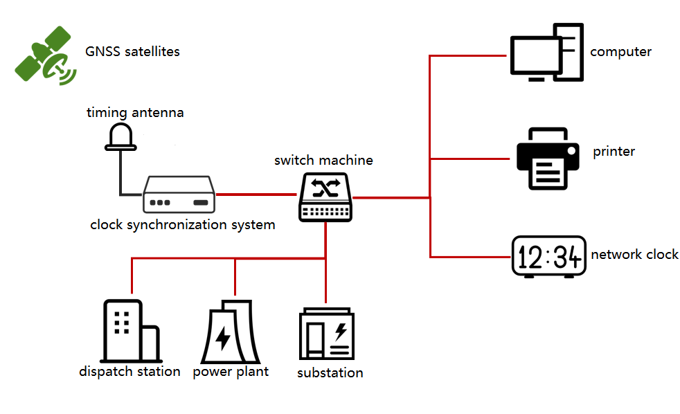
In the communication sector, GNSS satellite timing is primarily applied in the construction and management of mobile communication networks. By achieving precise time synchronization among base stations, the quality and stability of wireless communication can be enhanced. Since alternating current (AC) is commonly used in daily life, the direction of current in AC changes over time. When different power grid devices are interconnected, inconsistencies in time can lead to discrepancies in peak and valley periods, resulting in unnecessary energy loss or even equipment damage and network paralysis, causing widespread power outages.
Furthermore, GNSS satellite timing can be utilized for troubleshooting and maintenance of network faults, thereby improving the service level of telecommunication operators.
3.3 The Value of GNSS Satellite Timing in the Scientific Research Field
In scientific research, GNSS satellite timing holds significant value. For example, in astronomical observations, precise measurement of celestial bodies' motion trajectories can be achieved through GNSS satellite timing. In geological exploration, GNSS satellite timing aids scientists in studying the structure and evolution processes of the Earth's interior. In biomedical research, GNSS satellite timing can be applied in areas such as drug development and disease diagnosis.
4.Summary
With the continuous advancement of the digital wave, high-precision timing services will enter more industries and give rise to more application scenarios. The importance of timing-related equipment and systems is becoming increasingly prominent, gradually evolving into vital national information infrastructure.
Of note, GNSS timing can cover the entire globe, providing highly accurate and reliable timing signals whether on land, at sea, or in the air. This global coverage makes satellite timing systems an ideal choice for many application fields, and it's also an important area of competition among many superpowers.
I will appreciate it if you find this article helps you a lot. Read the following articles to get more information about GNSS.
More Technical Questions
1. Methods to Maintain the Long-Term Performance of Quartz Flexure Accelerometers
2. Analysis of Temperature Characteristics of Quartz Flexible Accelerometer
3. MEMS Accelerometers for Analyzing Mechanical Vibrations
4. Maximizing GNSS Applications in Land Vehicles Systems
5. Failure Mode Analysis of Quartz Flexure Accelerometer
6. Improvement of Temperature Stability of Quartz Flexible Accelerometers
Products in Article