



Introduction
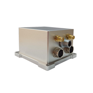
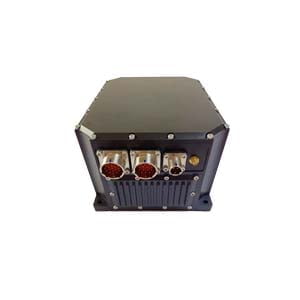
ER-GNSS/MINS-07(Low-cost Single Antenna MEMS Integrated Navigation System) is equipped with a highly reliable MEMS IMU and integrates a single-antenna full-system multi-frequency positioning satellite module. It is a low-cost single-antenna integrated navigation system.
Equipped with a integrated navigation fusion algorithm, it can provide continuous, accurate and reliable positioning, attitude, and speed information, with attitude up to 0.1° and heading 0.1°.
It uses a low-cost MEMS inertial measurement unit (IMU), internally integrated with a three-axis MEMS gyroscope and accelerometer, and a -40℃~+80℃ full-temperature range temperature compensation algorithm, which greatly reduces costs while ensuring core performance.
Different from the complex structure and cost of traditional dual-antenna solutions, ER-GNSS/MINS-07 adopts a single-antenna full-system multi-frequency design to achieve high-precision positioning and speed measurement.
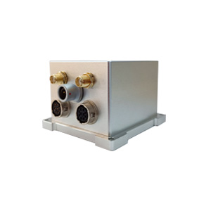
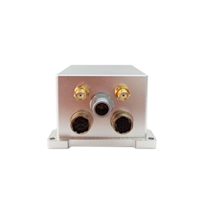
The precision aluminum alloy shell has high reliability and adapts to harsh environments. It has a variety of communication interfaces and provides standardized user communication protocols to meet aviation, land and other applications.
Feature
- The system can provide accurate combined navigation information, with attitude up to 0.1° and heading 0.1°.
- High reliability and low-cost MEMS IMU. Operating temperature -40℃~+80℃.
- Built-in single-antenna full-systemmulti-frequency GNSS module, supporting single-antenna high-precision positioning and speed measurement.
- Multiple data interfaces, easier to install and use, supporting RS422/RS232 and CAN.
- Precision aluminum alloy housing, high reliability, can be widely used in land and aviation.
Application areas
UAV, flight recorder, ADS
Specification
1.System parameters
| ER-GNSS/MINS-07 | ||
| Roll & Pitch | 0.1° | |
| Heading (dynamic) | 0.2° | |
| Heading (magnetic compass) | 0.8° | |
| Speed accuracy | 0.02 m/s | |
| RTK 30 sec outage | Roll & Pitch | Heading |
| 0.05° | 0.1° | |
| Position (X/Y) | Altitude (Z) | |
| 1.0 m | 0.5 m | |
| RTK 60 sec outage | Roll & Pitch | Heading |
| 0.1° | 0.2° | |
| Position (X/Y) | Altitude (Z) | |
| 15 m | 3 m | |
| Alignment Time | 3 min | |
2.Sensor parameters
| IMU Performance | ||
| Item | Value | Unit |
| Gyro range | ±125、500、1000、2000 | deg/s |
| Gyro ARW | 0.21 | °/ √h |
| Gyro sensitivity | 4.37 @FS=±125
17.5@FS=±500 35.0@FS=±1000 70.0@FS=±2000 |
mdps/LSB |
| Gyro Bias instability | 3 | °/h |
| Acc Range | ±2、4、8、16 | g |
| Acc sensitivity | 0.061@FS=±2
0.122@FS=±4 0.244@FS=±8 0.488@FS=±16 |
mg/LSB |
| Acc Bias stability | 0.1 | mg |
| Barometer | ||
| Parameter | value | Unit |
| Range | 10~1200 | mbar |
| Accuracy 25℃, 750mbar | ±1.5 | mbar |
| Error band, -20℃~+85℃, 450~1100mabr | ±2.5 | mbar |
| Temperature | -40℃~+85℃ | \ |
| Long-term stability | ±1 | mbar/year |
| Magnetometer | ||
| Range | ±2 | gauss |
| Sensitivity | 11000 | LSB/G |
| Temperature Sensor
Sensitivity |
14 | LSB/℃ |
| Field Resolution | 1.2 | mgauss |
| X-Y-Z Orthogonality | 90±1 | Degree |
| Satellite Receiver | |||
| Supported Navigation System | GPS/BDS-2/BDS-3/GLONASS/Galileo/QZSS/SBAS/IRNSS | ||
| ANT Frequency | GPS: L1C/A,L2P, L2C, L5
BDS-2: B11, B21, B31 BDS-3: B11, B3l, B2a GLONASS: G1,G2 Galileo: El,E5b, E5a QZSS*: L1C/A, L2C, L5 SBAS*: L1C/A, L5 IRNSS*: L5 |
||
| Position Accuracy (RMS) | Single point positioning | Horizontal | 1.5m |
| Altitude | 3m | ||
| RTK
|
Horizontal | ±(8+10-6×D)mm
D represents the baseline length(mm) |
|
| Altitude | ±(15+10-6×D)mm
D represents the baseline length(mm) |
||
| Time accuracy (RMS) | 20ns | ||
| Speed accuracy (RMS) | 0.02m/s | ||
| First positioning time | 24s | ||
| Power & Interface | |
| Supply Voltage | 5~12V |
| Supply Consumption | 3W |
| Interface | 1-Way RS422 or 1-Way RS232 and 1-Way CAN and 1-Way TTL (NMEA output and RTCM input) |
| Environment | |
| Operate Temp | -40℃~+80℃ |
| Storage Temp | -55℃~+95℃ |
| Dimension | |
| Dimension | 40mm*40mm*45mm |
More Technical Questions
1. What Is GNSS-aided MEMS INS and How Does It Work?
2. How to Improve the Performance of MEMS Inertial Navigation Systems?
3. Full-temperature Performance Optimization Method For MEMS accelerometer
4. Classification And Performance Improvement Of MEMS Gyroscope
5. MEMS Accelerometer Packaging Technology
6. Performance Analysis of GNSS RTK Timing
More Products