

Quick Answer
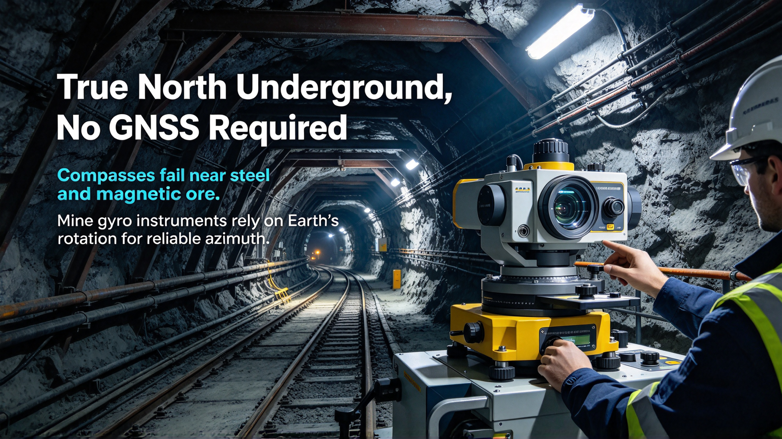
Underground mines have no GNSS, and magnetic compasses fail near steel supports, electrical equipment, and magnetic ore bodies. A mine gyro drill alignment instrument finds true north from the Earth's rotation, independent of magnetic interference and without needing a surface reference point. Mines use it to align drill rigs for blastholes, drainage and gas drainage boreholes, to orient tunnels and drifts, to extend underground control surveys, and to close breakthrough surveys between workings. Choose the model by accuracy class, underground suitability, and how easy the crew finds it to operate.
Underground, the two most common ways to find a direction stop working. There is no sky, so no GNSS. And a compass needle behaves badly next to steel arches, cable trays, and ore bodies that carry their own magnetism. Yet every blast hole, every drainage borehole, and every tunnel has to point somewhere, and that somewhere has to match the plan.
That is the job of the mine gyro drill alignment instrument. It measures true north using the rotation of the Earth, so it needs neither satellites nor a magnetic field. Set it up in a drift, and it tells you which way the drill must point, to the accuracy the job needs.
This article covers what these instruments actually do underground, the mine jobs that depend on them, and how to choose between the high-accuracy and the cost-effective classes.
Why Underground Orientation Is Hard
The problems start with the environment itself.
No GNSS. Satellite signals do not reach underground workings. Anything that depends on GPS-based positioning simply does not exist below the surface. Underground surveys must build their own reference, and every orientation has to come from a known line or from an instrument that does not need one.
Magnetic interference is everywhere. Steel rock bolts, arches, rails, ventilation ducting, cable trays, and electrical equipment surround every working face. Some ore bodies are magnetic themselves. A compass-based or magnetometer-based measurement in that environment reads the local steel and rock, not the Earth's field. The error is not small and it is not predictable.
Conventional control survey is slow and fragile. The traditional alternative is running a survey control network with a total station, carrying direction from a known line through the workings. It works, but every new face, every junction, and every drill move depends on the network being complete, accurate, and properly transferred. One bad setup propagates through everything after it.
Drill rigs move constantly. A rig drills a pattern of holes, then moves to the next position. Every move means the hole directions have to be re-established. If re-establishing direction requires waiting on a survey crew with a full control network, the drilling schedule waits too.
A gyro alignment instrument breaks all four problems at once. It needs no sky, ignores the steel around it, does not depend on a transferred control line, and gives an independent azimuth at each setup.
What a Mine Gyro Drill Alignment Instrument Does
The instrument is a gyro-based theodolite or alignment unit built for underground use. Set up over a point or on the drill itself, it levels, integrates the Earth's rotation, and reports a true-north azimuth. From that azimuth, the crew sets out the required hole direction or tunnel bearing.
Two properties make it different from everything else underground.
First, it is self-contained. It needs no known reference point, no surface tie-in, and no control network. Set it up anywhere with a stable base and it produces an absolute azimuth. That is what makes it useful at a fresh face where no survey control exists yet.
Second, it is independent of magnetism. Because it works from the rotation of the Earth, steel arches, electric cables, and magnetic ore do not change the answer. In a magnetically noisy environment, it is the only instrument that is not arguing with the rock.
The Jobs in a Mine
Drill Rig Alignment for Blastholes
Blast holes have to follow the planned burden and spacing, or the blast underperforms and the face comes out wrong. Underground, the hole direction is set from the azimuth and inclination marked on the drill. When the rig moves to a new position, the direction has to be re-established on the spot.
A gyro alignment instrument does this directly: set up, measure the reference azimuth, transfer the direction to the drill, start drilling. No waiting on the survey crew, no dependence on a transferred line. For production drilling, the instrument is what keeps the pattern honest.
Drainage and Gas Drainage Boreholes
Water drainage, gas drainage, and dewatering holes have to hit their targets: a water body, a gas zone, a fault. The collar position and the direction are both set from the plan, and underground the direction is the hard part. A misdirected drainage hole misses the target and the problem it was meant to solve stays unsolved.
These boreholes are also often drilled from difficult positions, close to the face and in tight spaces. The instrument has to be portable enough to set up where the rig is, not where the survey crew would prefer.
Tunnel, Drift, and Raise Orientation
Driving a tunnel or drift means holding a bearing and grade over distance. The bearing is set out from survey marks, and those marks are established with the gyro instrument when the face moves beyond the reach of the existing control. Raises and winzes, driven between levels, need the same absolute orientation at their collars.
Underground Control Surveys and Breakthroughs
Long workings are driven from two or more headings that must meet. The breakthrough survey is the classic case where gyro orientation earns its keep: the headings are oriented independently, then checked against each other as they approach. Independent gyro azimuths close the loop in a way that transferred control lines cannot, because each heading carries its own absolute reference.
Shaft and Decline Orientation
Shaft sinking and decline development need the surface alignment carried underground and verified. The gyro instrument provides the underground azimuth that ties the shaft centerline to the surface plan, independent of how the shaft was sunk.
Survey Connection Between Levels
Mines work on several levels, and the levels have to agree on direction. Transferring direction down a raise, a winze, or a ventilation connection is a classic place for error to creep in. A gyro setup on each level gives every level its own absolute azimuth, so the level networks are tied together by measurement, not by a long chain of transferred bearings that accumulates error with every step.
What a Gyro Alignment Setup Looks Like Underground
The routine is simple enough that a drill crew can run it, and it is worth knowing before the first shift.
The instrument is set up on a stable base near the drill position, or on a station mark when the job is a control survey. It is leveled, and the crew lets it integrate the Earth's rotation while it stays still. When the reading settles, the instrument reports the true-north azimuth of the setup line. The crew then transfers that direction to the drill or to the survey mark with a transit or laser, marks the direction, and the drill can start.
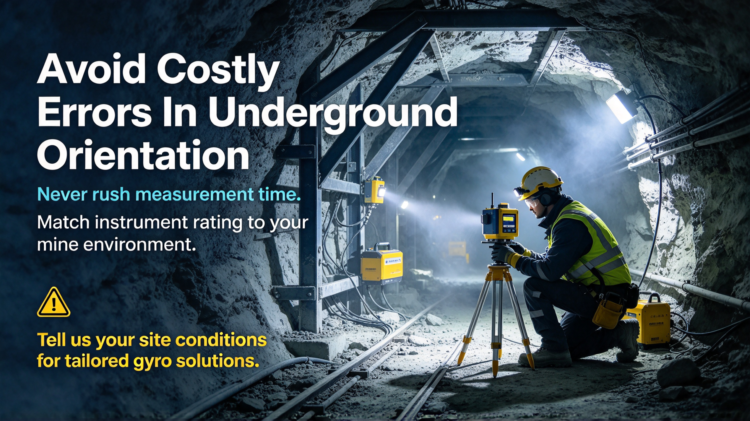
Two habits make the difference between good and sloppy results. First, give the instrument the integration time it asks for. The reading improves with time, and rushing it saves minutes at the cost of degrees at the end of the hole. Second, keep heavy moving equipment and obvious vibration away from the setup point while it is measuring. The instrument does not care about magnetic steel, but it does care about being bumped.
None of this requires exotic training. A competent surveyor or an experienced drill foreman picks it up in a shift or two. What matters is that the routine stays the same every time, so azimuths from different days and different crews can be compared.
How It Works
The principle is the same as surface gyro theodolites and north seekers. The gyroscope senses the Earth's rotation. Because the rotation vector points at true north, the instrument can solve for its own heading by integrating that signal while stationary.
The measurement is not instant. The instrument needs time to integrate the rotation signal accurately, and the better the accuracy required, the longer the integration. Underground, this means the crew plans for a stationary measurement at each setup. It is a few minutes per reading, not seconds, and the procedure matters: level the instrument, keep it stable, let it integrate, record the azimuth.
Temperature and vibration matter underground too. Mines are humid, dusty, and temperature changes along a drift. The instrument's accuracy specification only holds across its operating range, so the model has to be matched to the environment it will live in.
What to Look For When Choosing
Accuracy Class
The two meaningful classes are high-accuracy and cost-effective, and the choice is set by the job, not by preference.
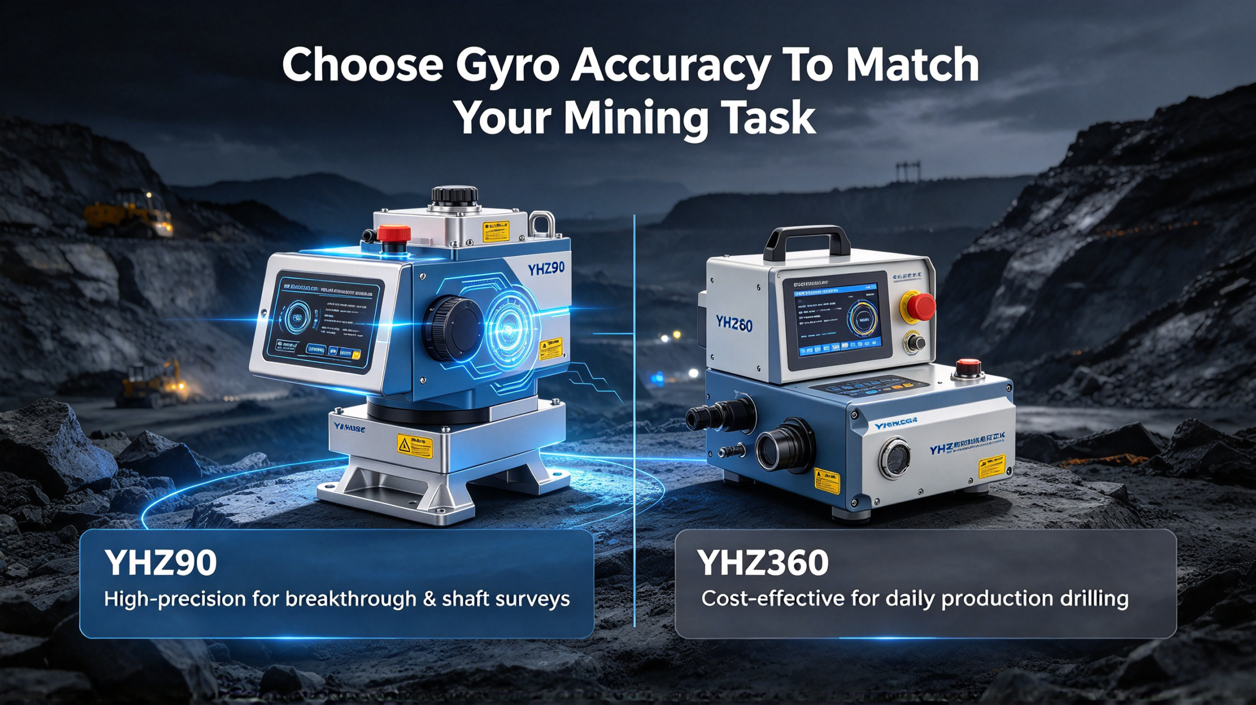
High-accuracy instruments, like the YHZ90 class, are for the work where a small azimuth error becomes a large position error over distance: long breakthroughs, shaft alignment, and control surveys that everything else depends on. Cost-effective instruments, like the YHZ360 class, handle the daily production work, drill rig alignment, and borehole orientation, where the required accuracy is lower and the instrument is used constantly.
The rule that actually works: buy the accuracy the job demands, and no more. A high-accuracy instrument used all day on blasthole alignment is wasted capability. A cost-effective instrument used to close a breakthrough is a false economy.
Underground Suitability
Mines are wet, dusty, and rough on equipment. Check how the instrument handles moisture, dust, and the temperature range of the mine, and whether it is rated for the mining environment it will work in. A surface instrument pressed into underground service will not survive the first season.
Ease of Operation
The instrument is used by surveyors and by drill crews, often in poor light and tight spaces. If the setup and reading routine is complicated, the routine will be skipped or done wrong. Ask who is going to operate it, and whether the training burden fits the operation.
Measurement Time and Workflow
Readings take minutes, not seconds. The choice between accuracy classes is partly a workflow choice: how long each setup takes, how many setups the shift needs, and whether the crew can do the measurement without blocking production.
Support and Calibration
A gyro instrument needs periodic checking and calibration. Ask about the support channel, calibration procedure, and spare parts before you buy, not after the first fault.
High-Accuracy vs Cost-Effective at a Glance
|
Consideration
|
High-accuracy class (YHZ90 style)
|
Cost-effective class (YHZ360 style)
|
|
Best for
|
Breakthroughs, shaft alignment, control surveys
|
Drill rig alignment, borehole orientation, daily production
|
|
Accuracy demand
|
Highest
|
Adequate for production jobs
|
|
Typical use
|
Critical, less frequent
|
Frequent, on every face
|
|
The honest choice
|
When the job's position error budget demands it
|
For the majority of production work
|
The two classes are complementary. Many mines run one high-accuracy instrument for the critical survey work and cost-effective instruments at the faces, so each job uses the tool that fits it.
Common Mistakes in Mine Gyro Alignment
Mistake 1: Using a magnetic compass near steel or magnetic ore. The reading looks plausible and is wrong. If the environment has steel or magnetic rock, the compass is not an option.
Mistake 2: Buying one accuracy class for everything. A single instrument that fits every job either overpays for production work or underachieves on critical surveys. Match the class to the job.
Mistake 3: Skipping the stationary measurement time. Gyro accuracy comes from integration time. Rushing the reading to save minutes produces an azimuth that costs hours later.
Mistake 4: Ignoring the environment rating. Dust, humidity, and temperature swing kill instruments that were never rated for them. Match the instrument to the mine.
Mistake 5: Not verifying the breakthrough with an independent check. Even a good gyro survey deserves a second opinion on a critical breakthrough. Independent azimuths from both headings, checked against each other, are what make the closure defensible.
FAQ
Q: What is a mine gyro drill alignment instrument?
A: It is a gyro-based instrument that measures true-north azimuth underground, independent of GNSS and magnetic interference. It is used to orient drill rigs, set out borehole directions, extend control surveys, and close tunnel and shaft alignments.
Q: Why can't a compass be used underground?
A: Compasses measure the magnetic field, and underground the field is distorted by steel supports, electrical equipment, and magnetic ore bodies. The reading reflects the local steel and rock rather than true north, with an error that is neither small nor predictable.
Q: How is it different from a total station survey?
A: A total station transfers direction from an existing control line, so every setup depends on the network behind it. A gyro instrument produces an absolute azimuth at each setup, independent of the network, which makes it useful at fresh faces and for closing long breakthroughs.
Q: Do I need the high-accuracy model?
A: Only if the job's position error budget demands it, such as long breakthroughs, shaft alignment, or control surveys. For daily production work like blasthole and borehole alignment, a cost-effective model like the YHZ360 class is the honest recommendation.
Q: How long does a measurement take?
A: Each reading takes a few minutes of stationary integration, with the time depending on the accuracy required. The procedure, level and hold the instrument steady, is part of the accuracy, not a formality.
Q: Can it be used in explosive atmospheres?
A: Underground conditions vary by jurisdiction and by zone. Check the mining certification of the specific model against the atmosphere and regulations where you operate before taking it underground.
Q: What is a breakthrough survey and why does it need gyro?
A: A breakthrough is where two headings, driven from different points, meet. Each heading carries its own absolute azimuth from a gyro instrument, so the closure is checked independently. That independence is what makes the final connection accurate.
Q: What is the difference between a mine gyro instrument and a north seeker?
A: They share the same core principle, finding true north from the Earth's rotation, but they are built for different work. A north seeker is a general-purpose orientation instrument used on the surface, on rigs, and on moving platforms. A mine gyro drill alignment instrument is built for the underground environment, with the portability, durability, and workflow for drill rig alignment and mine survey work.
Conclusion
Underground, the direction is the hard part. No GNSS, a magnetic environment full of steel and magnetic rock, and a production schedule that cannot wait for a survey network. A mine gyro drill alignment instrument answers all of it with one self-contained measurement: true north, from the rotation of the Earth, wherever it is set up.
The selection question is not "which brand" but "which class." High accuracy for the critical survey work, cost-effective for the daily faces, and the environment rating and operating routine that fit the mine. Get those right, and the instrument pays for itself in every correctly aligned blast and every borehole that hits its target.
Tell us what your operation drills, the accuracy your plans require, and the environment you work in, and we will recommend the right model from the mine gyro range we build, or tell you plainly when the lower-cost option is the honest choice.