

Quick Answer
In oil and gas, a north seeker provides a true-north reference where GPS is blocked or the magnetic field cannot be trusted: rig and wellhead orientation, surface references for directional drilling, pipeline survey and tie-in, tank and facility alignment, and offshore deck orientation. Land operations mostly use static MEMS units at 0.1° to 0.5° accuracy. Floating platforms and moving decks need dynamic models. Before buying, check the operating temperature range, the explosive-atmosphere requirements of the site, and whether you need a standalone unit or a module to integrate.
The field engineer's problem is usually not "which north seeker is the best." It is "which one works here."
Here can be a drilling rig in the desert, where surface temperatures kill consumer electronics. It can be a tank farm, where a small orientation error means a pipeline tie-in that does not meet. It can be a floating deck that never stays still long enough for a static measurement. One instrument does not solve all three.
Some of these jobs are handled fine by a cheap static unit. Others need a dynamic model plus a hard look at temperature and site certification. This article goes through the applications where a north seeker actually earns its keep in oil and gas, then applies the selection logic from our north seeker buying guide to oilfield conditions.
Why Oil and Gas Needs a North Seeker at All
A north seeker works out true north from the Earth's rotation, using gyrocompassing. No magnetic reference, no GPS, no line of sight to the sky. In an oilfield, that combination is exactly what most survey jobs need, and for three reasons.
First, the field is full of steel. Drill pipe, casing, rig structures, tank walls, and buried pipelines all bend the local magnetic field. A magnetic compass or a fluxgate-based tool near any of these gives an azimuth you cannot trust.
Second, the job usually wants true north, not magnetic north. Survey data, directional drilling plans, and pipeline coordinates are all referenced to true north. Working from magnetic north means applying a declination correction that drifts with time and location, and it is one more error source to manage.
Third, GPS is unreliable exactly where the work happens. Inside a rig structure, between tanks, under a pipe rack, or on a deck crowded with steel, satellite reception is weak or blocked, and multipath errors are common.
So the oil and gas industry uses north seekers the same way it uses a surveyor's transit: as a trustworthy true-north reference that does not depend on what is around it.
How a North Seeker Is Used in the Field
The actual field procedure is simpler than the spec sheet suggests. A crew doing a rig orientation works through the same routine almost every time.
The instrument is set up on a stable base near the point that needs orientation, or on the equipment itself if it can be leveled. It is leveled, and the measurement axis is aligned roughly with the direction of interest. Then the unit runs through its gyrocompassing routine, integrating the Earth's rotation for the required time. Once it settles, it reports a true-north azimuth, and the crew transfers that line to the rig or wellhead with a transit or laser.
Two habits separate good crews from sloppy ones. The first is keeping magnetic masses away from the instrument during the measurement. A north seeker does not need a magnetic field to work, but a large piece of steel sitting close by can still disturb the measurement, so the setup point matters. The second is repeating the reading. One measurement gives you a number; a second run that agrees gives you confidence. On critical jobs, crews take two readings and record both.
None of this requires exotic training. A competent surveyor or directional engineer picks it up quickly. What matters is that the procedure stays the same every time, so readings taken on different days and by different crews are comparable.
The Main Applications, One by One
Rig and Wellhead Orientation
Before a rig is skidded, a wellhead is positioned, or a workover unit is aligned with an existing well, someone has to establish the direction. The well plan specifies a target azimuth, and the rig or wellhead has to face it.
This is a static job. The instrument sits on a stable platform, takes a few minutes to integrate, and gives the crew a true-north line to work from. A MEMS static north seeker at 0.1° to 0.5° accuracy covers the vast majority of land rig and wellhead orientation work. FOG-level precision is rarely justified here.
Surface Reference for Directional Drilling
Directional wells are steered downhole with magnetic MWD or gyro tools, and both need a defensible reference at the surface. Magnetic MWD azimuth is referenced to magnetic north, so the conversion to true north depends on an accurate declination value at the well site. A gyro tool is referenced to true north, but the surface tie-in still has to be established and checked.
The north seeker provides that ground truth. Surveyors set it up near the wellhead, record a true-north azimuth, and use it to verify the magnetic declination applied downhole or to initialize the surface reference for gyro operations. When the surface reference and the downhole data agree, the trajectory is defensible.
For this role, accuracy and repeatability matter more than speed. A static instrument with documented accuracy, run through the same procedure each time, gives the field a reference they can stand behind.
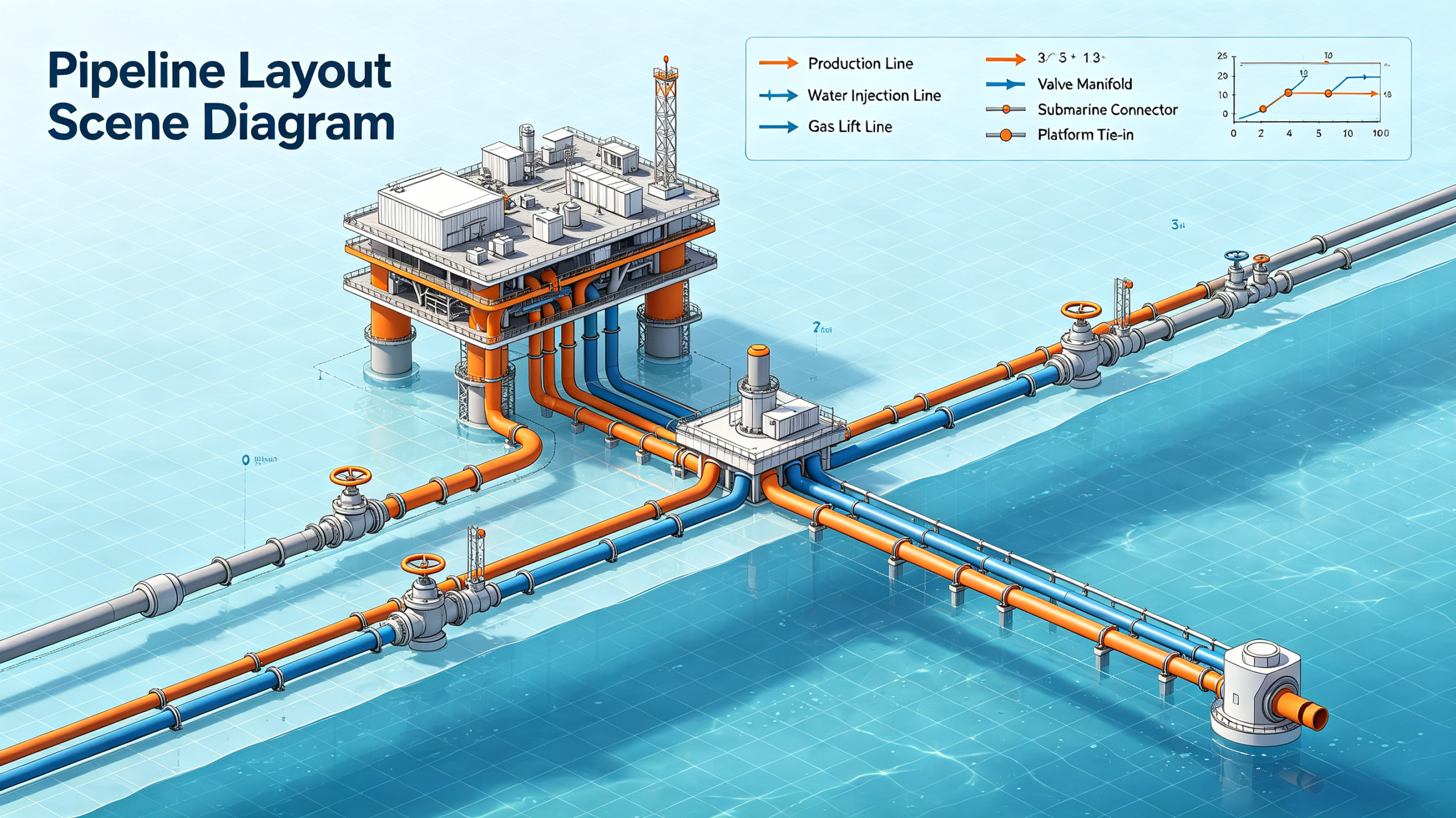
Pipeline Survey and Tie-In
Pipelines are laid to coordinates, and every tie-in, crossing, and bend has to land where the plan says. Survey crews establish orientation for tie-in points, set direction for trenchless crossings, and check alignment before welding.
In open terrain, GPS handles most of it. In congested areas, under pipe racks, near compressor stations, and in the shadow of steel structures, a north seeker takes over. It is also the practical answer for the entry and exit points of HDD crossings, where the bore has to come up in a specific orientation.
A portable static north seeker is the usual tool. Crews set it up, take the reading, move on. Measurement time of a few minutes is rarely a problem in this workflow.
Multi-Well Pads and Cluster Wells
Modern drilling runs several wells from one pad, and every wellhead needs its own orientation. The pad is crowded with rig equipment, pipe, and steel, and the magnetic environment gets worse with each added well. A single north seeker set up at a reference point can serve the whole pad: surveyors establish one true-north line and transfer it to each wellhead position with a transit. Because the reference is consistent, all the wells on the pad share the same coordinate truth, and the survey records line up with the drilling plan.
Storage Tanks and Facility Alignment
Tank farms, valve stations, and processing facilities need orientation for foundations, nozzles, flanges, and equipment bases. The accuracy required is usually modest. A tank nozzle pointed a degree off is rarely a problem; a pipeline that has to meet it is a different story.
The honest advice here is not to overbuy. If the task is general facility orientation with no tight tie-in, a low-cost single-axis north seeker gives a serviceable true-north reference at a fraction of the price of a high-accuracy unit. Save the precision budget for the jobs that actually need it.
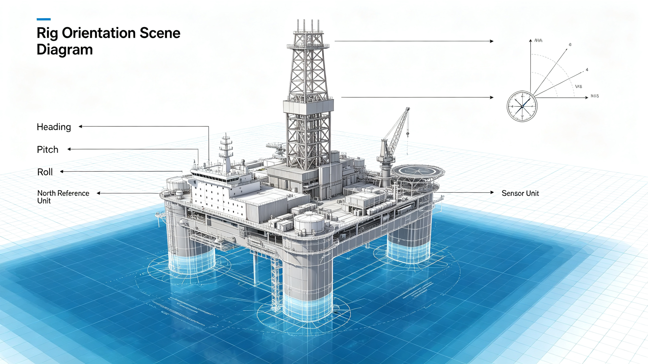
Offshore Platforms and Floating Decks
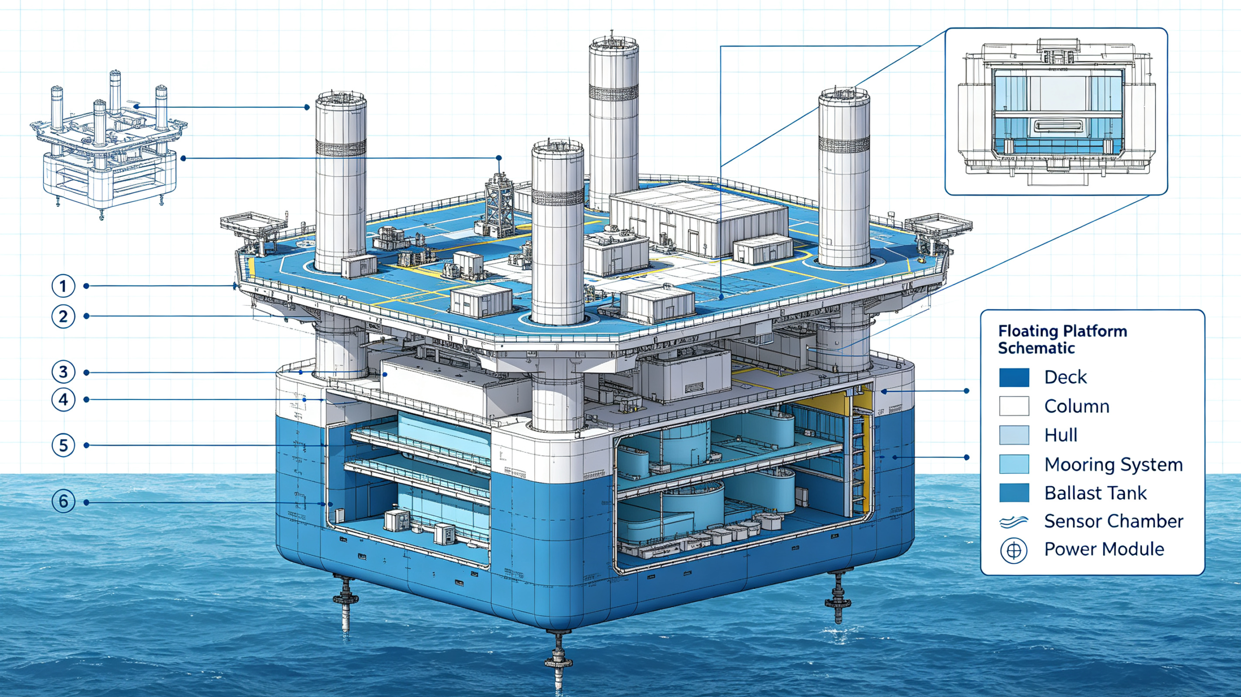
Offshore changes the rules. A fixed jacket platform is a static environment, and the same logic as land applies. A floating rig or a moving deck is not.
On a floating platform, the deck pitches, rolls, and yaws continuously. A static north seeker cannot integrate through that motion, so the answer is a dynamic north seeker that tracks heading while moving, typically aided by GNSS or other references. Dynamic models cost more and need more setup, but on a moving deck there is no alternative.
Downhole Survey Support
A north seeker also supports the downhole side of the operation indirectly. The surface true-north reference is what lets operators close the loop between directional drilling data and the final survey. When a well's trajectory is verified against a gyro survey, the whole chain, surface reference, downhole tools, and survey procedure, has to agree.
If you work with gyro while drilling or wireline gyro surveys, the surface reference discipline matters as much as the downhole tool. Our comparison of gyro tools and MWD covers that side of the equation.
What Oil and Gas Changes About the Selection
The six selection factors from the general guide still apply, but oilfield conditions sharpen a few of them.
Temperature. This is the one that catches people. A north seeker rated for a 25°C lab is not going to survive a summer day on a desert rig, let alone sit on hot steel. Match the operating temperature range to the site, and ask whether the accuracy figure holds across that range, not just at room temperature.
Explosive atmosphere compliance. Much of the oil and gas surface environment is a classified hazardous area. If the instrument is used where flammable gas can be present, check its certification against the site's zone and gas group requirements before you take it into the field. This is a site-safety question, not a spec-sheet detail, and it should be settled before purchase, not on the day of the job.
Protection. Sand, water mist, mud, and rough handling are normal. Check the ingress protection rating and the shock and vibration limits against the actual conditions.
Static or dynamic. Land work is almost always static. Floating platforms and moving equipment are dynamic, and there is no workaround. Decide this first.
Measurement time. If the crew sets up and reads once per location, a few minutes of integration time is irrelevant. If the operation needs a heading on a tight schedule, faster measurement matters.
Integration. A standalone unit covers most survey and orientation work. If you are building a north-seeking capability into a rig positioning system or a specialized tool, a directional module with defined interfaces is the right form.
Applications at a Glance
|
Application
|
Typical requirement
|
Suggested type
|
|
Rig and wellhead orientation
|
Static, 0.1°–0.5°
|
MEMS static north seeker
|
|
Surface reference for directional drilling
|
Static, high repeatability
|
MEMS static, or FOG for maximum precision
|
|
Pipeline survey and tie-in
|
Portable, static
|
MEMS static, portable
|
|
Tank and facility alignment
|
Low cost, ~1°
|
Low-cost single-axis
|
|
Offshore floating decks
|
Dynamic, in-motion heading
|
MEMS dynamic north seeker
|
|
System integration
|
Module, defined interfaces
|
North-seeking directional module
|
How Ericco's North Seeker Families Fit the Oilfield
Ericco's range covers each row of the table above, so the choice comes down to matching the family to the site.
- ER-MNS-04A/B and ER-MNS-05A are dynamic north seekers, built for floating platforms, moving decks, and equipment that cannot stop to measure.
- ER-MNS-06A is the cost-effective static model, a sensible default for rig and wellhead orientation, pipeline survey, and general facility work on land.
- ER-MNS-08 is the ultra-low-cost single-axis unit, enough for tank farms and low-accuracy orientation where price matters most.
- ER-MNS-09 is the directional module for engineers integrating north seeking into their own systems, such as rig positioning or survey tools.
- FOG north seekers sit at the top of the accuracy range, for surface references where the maximum precision is genuinely required.
The mining-specific systems in our range, such as the YHZ90/360 alignment tools, are built for underground work and do not normally come into play in oil and gas. If you are unsure which family fits your site, that is a conversation worth having before you buy, not after.
Common Mistakes in Oil and Gas North Seeker Selection
Mistake 1: Using a static unit on a floating deck. A static north seeker integrates the Earth's rotation over minutes. Deck motion corrupts that integration completely. On a moving platform, only a dynamic model works.
Mistake 2: Ignoring the temperature rating. The instrument has to work at the site's actual temperature, with accuracy intact. A unit that only performs at room temperature is a field failure waiting to happen.
Mistake 3: Trusting a compass near steel. On a rig, in a tank farm, or beside a pipeline, the magnetic field is distorted. The readings look fine until they are checked against a true-north reference.
Mistake 4: Skipping the hazardous-area check. Taking an uncertified instrument into a classified area is a safety issue, and it can stop a job on the spot. Confirm certification for the site's zone before the instrument is ordered.
Mistake 5: Buying FOG accuracy for a tank farm. If the job tolerates 1°, a 0.1° instrument is money spent on nothing. Match the accuracy to the actual requirement.
Mistake 6: Forgetting the procedure. A good north seeker run with sloppy procedure produces bad data. Set up level, keep magnetic masses away, and follow the same measurement routine every time so the results are comparable.
FAQ
Q: What is a north seeker used for in oil and gas?
A: It provides a true-north reference for rig and wellhead orientation, directional drilling surface references, pipeline survey and tie-in, tank and facility alignment, and offshore deck orientation, in environments where GPS is weak and the magnetic field cannot be trusted.
Q: Why not just use GPS or a magnetic compass?
A: GPS is often blocked or multipath-corrupted around rigs, tanks, and steel structures, and it cannot provide a heading reference indoors or under cover. A magnetic compass is corrupted by the steel that is everywhere in an oilfield. A north seeker depends on neither.
Q: What is the difference between land and offshore selection?
A: Land work is usually static, so a MEMS static north seeker covers most jobs. Floating platforms and moving decks need a dynamic north seeker that tracks heading during motion, typically aided by GNSS.
Q: Do I need an explosive-atmosphere certified north seeker?
A: If the instrument will be used in a classified hazardous area, check its certification against the site's zone and gas group requirements before purchase. This is a site-safety decision and should be settled before the instrument reaches the field.
Q: What accuracy do I need?
A: For rig and wellhead orientation, 0.1° to 0.5° from a MEMS static unit is enough for most operations. Facility alignment can tolerate about 1°. FOG-level precision is justified only for the most demanding surface references.
Q: How long does a north seeker take to give a reading?
A: Static instruments typically need from a few seconds to a few minutes to integrate the Earth's rotation, depending on the accuracy required. Dynamic models report heading continuously while moving. For most oil and gas setup work, a few minutes per reading is perfectly acceptable.
Q: How does a north seeker relate to MWD and gyro tools?
A: It establishes the surface true-north reference that magnetic MWD needs to convert to true north, and that gyro tools use as a tie-in. A defensible trajectory depends on the surface reference and the downhole data agreeing.
Conclusion
Most oil and gas north seeker jobs are not hard once the environment is taken into account. Land rigs, wellheads, pipelines, and tanks are static work, and a MEMS static unit at the right accuracy covers them. Floating platforms are the exception, and they need a dynamic model. Temperature and hazardous-area certification are the two things that turn a good instrument into a usable one, and both should be checked before purchase.
If you tell us the application, the site temperature, and whether the platform moves, we can point you to the right family from the range we build, and tell you when a cheaper unit is the honest recommendation. Send the details through the contact page and we will come back with a specific answer.