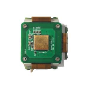
Strap-down Inertial Navigation System is an inertial navigation system that connects inertial instruments directly to a carrier and uses a computer to complete the navigation platform function.
Basic principle
The inertial measurement device is directly connected to the carrier, and then its output is solved by the mathematical platform (also known as the parameters of the strapdown matrix transformation to the navigation coordinate system). The inertial measurement devices of the system are angular rate gyroscope and accelerometer, which are fixed on the carrier and measure the physical quantities in the carrier coordinate system.
System characteristic
The gyro and accelerometer directly bear the motion (including vibration) of the carrier, so the dynamic error of the strapdown system is larger than that of the platform system, and the reliability and impact resistance of the sensitive device are required to be higher. Compared with flexible gyro, fiber optic gyro has more outstanding advantages in strapdown system.
Advantages:
Since the inertial instrument is directly connected to the carrier, the electromechanical navigation platform is eliminated, which brings many advantages to the system:
1. The volume, weight and cost of the whole system are greatly reduced, usually the gyroscope and accelerometer only account for 1/7 of the navigation platform;
2. Inertial instrument is easy to install and maintain, easy to replace;
3. The inertial instrument can give the axial linear acceleration and angular velocity, which is the information needed by the control system. Strapdown systems can provide more navigation and guidance information than desktop systems.
4. Inertial instrument is easy to use redundancy configuration, improve the performance and reliability of the system.
According to the different gyroscopes used, it is divided into rate strapdown inertial navigation system and position strapdown inertial navigation system. The former uses rate gyroscope to output instantaneous average angular velocity vector signal; the latter uses free gyroscope to output angular displacement signal. The strapdown inertial navigation system eliminates the platform, so the structure is simple, small in size, and easy to maintain. However, the gyroscope and accelerometer are directly mounted on the aircraft, and the working conditions are poor, which will reduce the accuracy of the instrument. The accelerometer of this system outputs the acceleration component of the body coordinate system, which needs to be converted into the acceleration component of the navigation coordinate system by a computer, which requires a large amount of calculation.
In order to obtain the position data of the aircraft, the output of each measurement channel of the inertial navigation system must be integrated. The drift of the gyroscope will increase the angle measurement error proportionally with time, and the constant error of the accelerometer will cause a position error proportional to the time square. This is a divergent error (increasing with time), which can be corrected to obtain accurate position data by composing the three negative feedback loops of the Shura loop, gyro compass loop and Foucault loop.
Shula loop, gyrocompass loop and Foucault loop all have the characteristics of undamped periodic oscillation. Therefore, the inertial navigation system is often combined with navigation systems such as radio, Doppler and astronomy to form a high-precision integrated navigation system, which makes the system both damping and correcting errors.
The navigation accuracy of the inertial navigation system is closely related to the accuracy of the earth parameters. High-precision inertial navigation systems must use reference ellipsoids to provide parameters for the shape and gravity of the earth. Due to factors such as uneven crust density and topographical changes, there are often differences between the actual values of the parameters at various points on the earth and the calculated values obtained from the reference ellipsoid, and this difference is also random. This phenomenon is called a gravity anomaly . The gravity gradient instrument being developed can measure the gravity field in real time, provide earth parameters, and solve the problem of gravity anomalies.
If you want to get more details about inertial navigation system,pls visit https://www.ericcointernational.com/inertial-navigation-system
More Technical Questions
1.MEMS and FOG: How Should you Choose Inertial Navigation System?
2.What is Inertial Navigation System?
3.In Autonomous Flight: How Inertial Navigation Systems Work
4.Development and Application of Inertial Navigation System
5.Introduction to Inertial Navigation Systems
6.Heading and Attitude Reference System and Inertial Navigation System
Products in Article