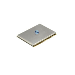
A GNSS module is a compact electronic device designed to receive signals from multiple satellite constellations and calculate precise geographical coordinates. The primary objective of GNSS modules is to enable accurate positioning, navigation, and timing (PNT) information for a diverse array of applications.
The module is much like other system-on-modules (SoMs) in that it integrates multiple components into a small PCB. This can then be easily added to a main board through an edge connector, surface-mount connection, or coax connector. The idea is to prepackage all the required components needed for signal acquisition, amplification/filtering, and data output over positioning data over a standard interface (SPI, UART, etc.). Some GNSS modules include an integrated antenna, either as a printed patch antenna or ceramic chip antenna.
- Components of a GNSS Module:
- Antenna:The antenna is the first point of contact for satellite signals. It receives signals from various GNSS constellations, converting them into electrical signals for further processing.
- RF Front-End:The Radio Frequency (RF) front-end is responsible for amplifying and filtering the received signals. It helps to enhance the signal quality and ensures that only relevant signals are passed on.
- Processor:The processor manages the overall operation of the GNSS module. It executes algorithms for signal processing, coordinates calculation, and data fusion. The efficiency of the processor contributes significantly to the module's performance.
- Memory:GNSS modules incorporate memory for storing navigation data, firmware, and other relevant information. This allows for quick retrieval of data and enhances the module's responsiveness.
- Interfaces:To facilitate integration into various devices, GNSS modules feature interfaces such as UART, SPI, or I2C for communication with external systems. These interfaces enable seamless connectivity and data exchange between the GNSS module and the host device.
- Significance of GNSS Modules:
- Accurate Positioning:The modules provide precise positioning information, allowing users to determine their location with high accuracy. This is crucial for applications ranging from navigation systems in vehicles to location-based services in smartphones.
- Navigation and Timing:In addition to positioning, GNSS modules contribute to accurate navigation and timing information. This is essential for activities such as aviation, maritime navigation, and synchronization of critical systems.
- Versatility:They support multiple satellite constellations, ensuring a global coverage footprint. This versatility enhances their usability across diverse environments and applications.
- Emerging Technologies:GNSS modules are integral to the development of emerging technologies, including autonomous vehicles, precision agriculture, and the Internet of Things (IoT). These applications rely on accurate positioning data for optimal performance.

- Main parameters to measure the performance of GNSS modules
3.1 Update Rate
Update rate, often measured in Hertz (Hz), indicates how frequently the GNSS module provides position updates. A higher update rate can be beneficial in applications requiring real-time or dynamic positioning information. The required update rate depends on the nature of the application. Static applications, like surveying or geodetic mapping, may not necessitate high update rates, while dynamic applications, such as driving or walking navigation, benefit from more frequent updates. In high-precision applications like RTK (Real-Time Kinematic) positioning, where centimeter-level accuracy is crucial, the update rate is a key factor in achieving precise and dynamic positioning.
3.2 Positioning Accuracy
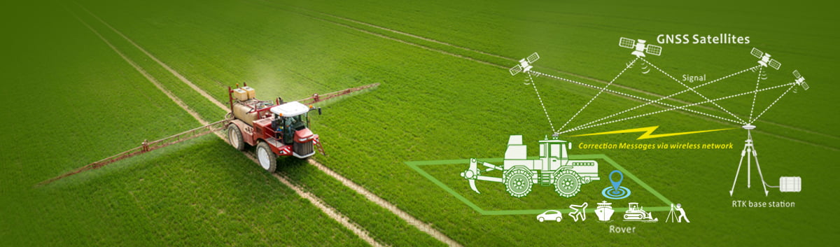
Positioning accuracy is a critical metric that evaluates how closely the reported position aligns with the actual location. It is typically measured in meters and can vary based on factors such as satellite geometry, signal quality, and environmental conditions. It can be affected by different sources of errors, including signal multipath, receiver noise and sensitivity, satellite geometry and clock errors. Techniques such as RTK and DGNSS are used to enhance positioning accuracy. RTK involves using a base station to transmit corrections to the rover, while DGNSS uses a reference station to correct positioning errors.
The required level of positioning accuracy varies based on the application. High-precision applications like surveying or geodetic mapping demand centimeter-level accuracy. Specialized modules, exemplified by ER-GNSS-M02, feature a sophisticated RTK algorithm engine, simplifying the attainment of centimeter-level positioning precision. What’s more, complemented by a built-in IMU utilizing a tight combination algorithm, these modules are adept at consistently producing stable and reliable navigation and positioning data even in areas with significant satellite signal blockage.
3.3 TTFF
Time to First Fix (TTFF) encapsulates the time it takes for a GNSS module to acquire signals from satellites, process the data, and determine an accurate position fix. Faster TTFF is desirable, especially in applications requiring quick and accurate location information. Generally, three starting conditions are often considered depending on the initial conditions of the modules:
- Cold start:in this case, no information is available at the receiver and therefore the receiver entails a full search of the sky for all satellites;
- Warm start:in this case, the receiver has a valid almanac (either stored from a navigation message recently decoded or obtained via other means, e.g. through Assisted GNSS). Furthermore, a rough position is also needed together with approximate information on frequency offset.
- Hot start: in this case, the receiver has both accurate ephemeris and information on frequency offset as well as an accurate initial solution.
The TTFF for a cold start is typically between 2 and 4 minutes, a warm start is 45 seconds, and a hot start is 22 seconds. In older hardware where satellite search is slower, a cold start may take more than the full 12.5 minutes. Notably, advanced modules like ER-GNSS-M02 mentioned above also showcase remarkable improvements in TTFF. For instance, its cold start duration is impressively short, ranging between 0 and 24 seconds.
Conclusion
The GNSS module, a product of GNSS technology, possesses broad applications and significant potential value, finding crucial applications in diverse fields, including military, aviation, navigation, automobile navigation devices, automatic navigation systems, mobile communication, power electronic devices, and various terminals requiring precise location services.
GNSS modules are integral components in the technological fabric of today, providing accurate positioning, navigation, and timing information across diverse applications. With their compact design and global satellite support, these modules offer essential solutions for industries ranging from military and aviation to mobile communication and emerging technologies. As key parameters like positioning accuracy, update rate, and TTFF continue to drive advancements, GNSS modules stand at the forefront, shaping the landscape of precise location services and contributing to the seamless integration of cutting-edge applications.
I will appreciate it if you find this article helps you a lot. For more information about GNSS products, you may read the articles and products below. Always feel free to contact us:
Email: info@ericcointernational.com
More Technical Questions
1. Application of GNSS-RTK Positioning Technology in ICV Testing
2. Integration of GNSS Modules in Aviation: Precision Navigation for Unmanned Aerial Vehicles (UAVs)
3. Decoding Navigation Technology: GNSS Boards vs. GNSS Modules – Unveiling the Distinctions
4. Distinctions Between GNSS Receivers and Antennas
5. Equipment Used in GNSS: Navigating Precision and Accuracy
6. How to select a GNSS antenna?
Products in Article